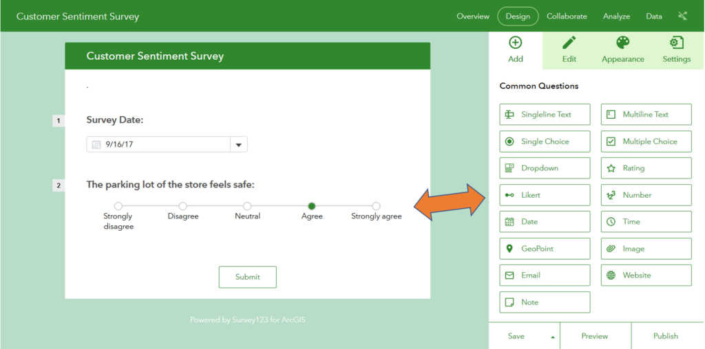
Survey123 for ArcGIS allows you to create forms on your smartphone, tablet, laptop or desktop. Ask your most important questions and collect valuable data from anywhere.

Download surveys ahead of time to work offline, so you won’t be limited to areas with available data connectivity. Or streamline workflows by working online, where data collected in the field is immediately synced with others back at the office.
Create questions in a simple drag and drop style, or build them with a spreadsheet (XLSForm compatible) for more complex surveys. Surveys also allow for embedded audio and images, for more detailed questionnaires.

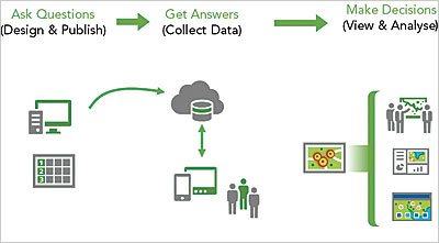
Survey123 for ArcGIS in 1-2-3 steps
- Ask Questions – Build simple or complex forms and publish to ArcGIS.
- Get the Answers – Complete surveys in the field, and capture answers from web or mobile.
- Make Better Decisions – Get survey answers in real-time, and analyze findings for more informed decision making.

Survey123 for ArcGIS used across the industries
- Reducing litter to restore Chesapeake Bay
- Assessing health of water utility networks
- Monitoring and maintaining petroleum pipelines
- Protecting the public from drunk drivers
- Creating damage assessment surveys after natural disasters
- Defeating Polio in Iraq
- Treating over 1000 Syrian refugees
- Students learning GIS while promoting public safety

Endless potential and seamless integration with other powerful esri apps including Collector for ArcGIS, Explorer for ArcGIS, Navigator for ArcGIS, and Workforce for ArcGIS.
Ask Questions, Get Answers
Contact our GIS experts at support@geomarvel.com to learn more about Survey123 for ArcGIS, and how this powerful surveying tool can help your organization.


