Spatial-temporal GIS
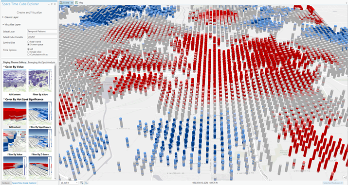
4D GIS has developed into an essential component of GIS applications, incorporating 2D and 3D data with time. 4D GIS integrates, manages, and analyzes spatial and nonspatial information, providing quality visualization, simulation, and communication. While also facilitating better decision making by providing a geographic representation of the full scope of a project.
4D GIS helps project planners visualize the progress of a project at all levels. Both spatial and nonspatial information can be integrated into the GIS platform for analysis, easy management, and to create the final visualization. 4D visualization provides easy scheduling techniques, with easy linkage between activities and scheduling information. 4D models can also increase the understandability of the schedule of a project, and force the user to acknowledge risks during project execution. In the end, 4D GIS models reduce costs by early identification of potential issues, such as time conflicts and safety concerns.
4D GIS in Emergency Situations
This valuable asset could be used in real-time to create a GIS application to model the shortest route out of a building in an emergency scenario like a fire. Phones with access to this model may be pinged with a route to guide that person to safety. The fourth dimension, time, may be incorporated as events change, like the fire blocking your safe passage. Now the application can reroute and find the next shortest path to exit the building.

Get Support
4D GIS can provide deeper insights into data over time. Add time into the mix, and learn more from our industry experts by contacting us today.


