")
According to the United Nations, food security means that all people have physical and economic access to food at all times.
But the reality is, that population density is causing agricultural limitations and contributing to the spread of food deserts – or impoverished areas where access to fresh and affordable food is limited.
That’s where GIS comes in. GIS can be used to observe the geographic links and factors that threaten food sources across various environments, enabling better food desert identification globally.
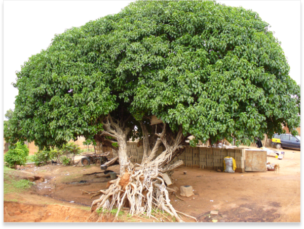
Northern Ghana experiences annual flooding that impacts local farmers and devastates the community. But GIS is helping to combat the severe effects flooding has on food security in the region.
Through a variety of mapped features, such as physical, administrative, environmental, cultural, socio-economic and territorial factors, communities can be a part of the discussions regarding food security.
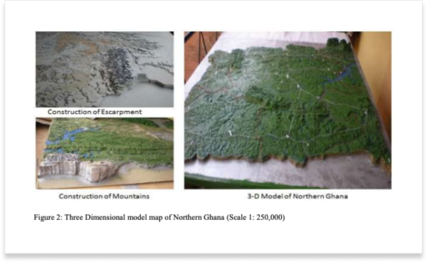
Image from Mofa Food Security
The result is a 3D map that provides communities an opportunity to plan for development around perennial flooding issues and long drought periods that follow.
GIS models such as this are essential to regions like Northern Ghana to successfully work toward sustainable development.
The Global Information and Early Warning System (or GIEWS) has worldwide remote sensing data that can monitor major food crop conditions and assess the future of food production. The technology can provide map data around water availability and vegetation health and offer essential insights in the process.
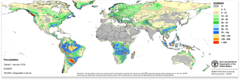
Image from Food and Agriculture Organization
Agricultural areas likely to be affected by dry spells or droughts can be identified with the Agricultural Stress Index (ASI), thanks to the following:
Geospatial technologies and insights are changing the landscape of predictive models and the monitoring and strategic management of food security for all of humanity.
We hope you found this educational and beneficial for you and your organization. If you have any further questions about GIS and food security or need any other ArcGIS support, feel free to start a conversation with our team of industry experts today!