The world is getting bigger with the help of GIS, and you don’t have to be a developer to leverage the power of map-based apps. Use AppStudio for ArcGIS to provide virtual tours, display critical information, and crowdsource information with a little help from your community.
Are you interested in building a GIS-focused native app, but not sure where to start?
Don’t have any coding experience? Great! With their out-of-the-box templates, AppStudio for ArcGIS allows you to create custom native apps for IOS and Android.
And what if you’re already a coding guru? Great! AppStudio for ArcGIS is for you too! You’ll be able to personalize your app by extending existing template features, or even build your very own app from scratch to display all your mapping needs!
AppStudio for ArcGIS gives you the ability to build your own app or use existing templates (Map Tour, Map Viewer, and Quick Report) to leverage existing public maps on ArcGIS Online and Portal for ArcGIS with ArcGIS Enterprise.
Map Tour
Create a map to show off your city or an area of interest.
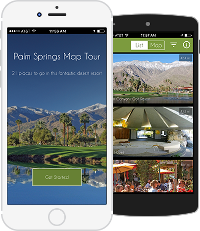
- Experience the unique desert of Palm Springs, California from the comfort of your own phone.
- But of course you should go there too, using this app as a guide to discover the 21 top spots to go see in person!
- Tour Music City! That’s Nashville for those of you following along.
- Take the map tour around Tennessee’s capitol city, and find out which 23 places to go see for yourself.
Map Viewer
Use this template to display your very own maps.
- Create a native app gallery of your ArcGIS Online public maps.
- Personalize the legend to display the most important data.
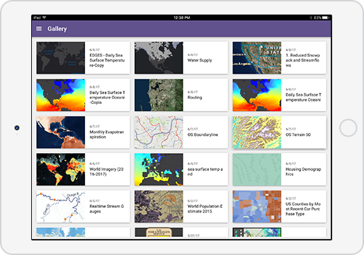
Image from esri
Quick Report
Configure this template to create an app for citizen engagement. Evacu8 won the AppStudio for ArcGIS App Challenge with their disaster event app that helps people gather information, coordinate efforts and get to safety.
Evacu8 is an app created to organize people in the midst of chaos. It sends people updated natural disaster news and information, the quickest evacuation routes, and the location of their nearest evacuation center. With all this rich information in one place, this app eliminates the need to monitor many websites to find everything you need in the event of a natural disaster near you.
Endless Possibilities
From crowdsourced tree locations and turtle sightings via GPS, to a map display of metered and non-metered car parking locations in South Australia. Check out the AppStudio Apps Showcase Gallery to see more examples of what’s possible with AppStudio.
Also check out the custom AppStudio app, LACO-Wiki Mobile, developed by us, GeoMarvel to validate land cover and land use maps for quick and efficient data collection.
Are you interested in creating a custom GIS native app, to take full advantage of AppStudio for your business? Contact our experts at support@geomarvel.com to begin implementing these powerful tools in your business today.

