GeoMarvel is proud to announce that we have earned the Esri Imagery Specialty designation. This recognition is awarded to Esri Business Partners who demonstrate advanced expertise in implementing & supporting imagery and raster capabilities across the ArcGIS ecosystem. It affirms our ability to help organizations operationalize imagery as a strategic data asset—not just a visual layer.

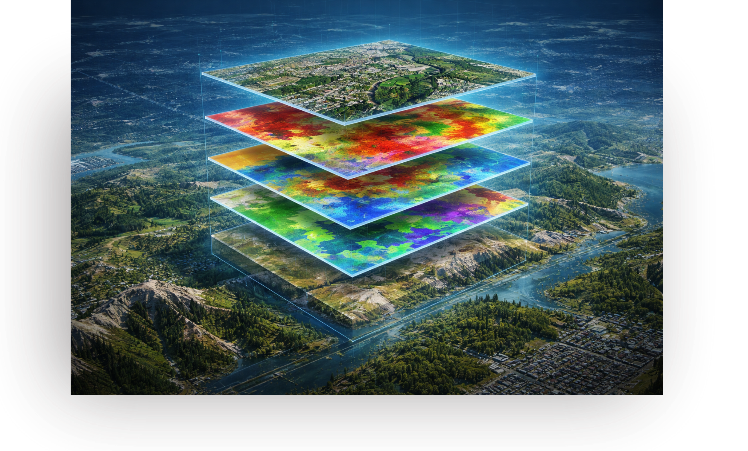
This designation reflects our experience delivering imagery-driven solutions across ArcGIS Enterprise, ArcGIS Pro, & ArcGIS Online. From architecting scalable image services to enabling distributed raster analytics, GeoMarvel designs environments that support secure storage, efficient processing, and high-performance delivery. Leveraging capabilities such as ArcGIS Image Server and ArcGIS Image for ArcGIS Online, we help clients manage growing imagery volumes while enabling advanced analysis at enterprise scale.
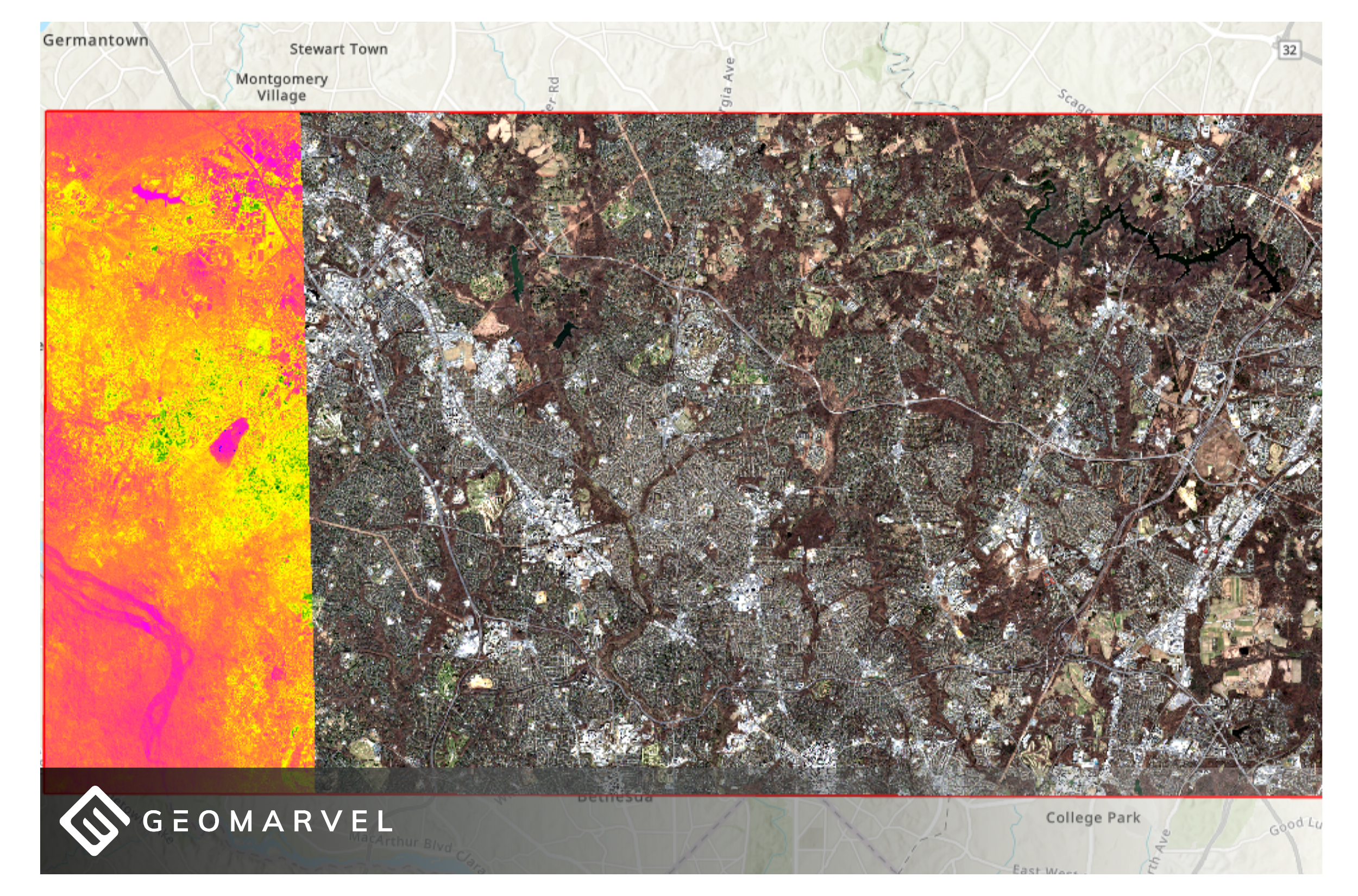
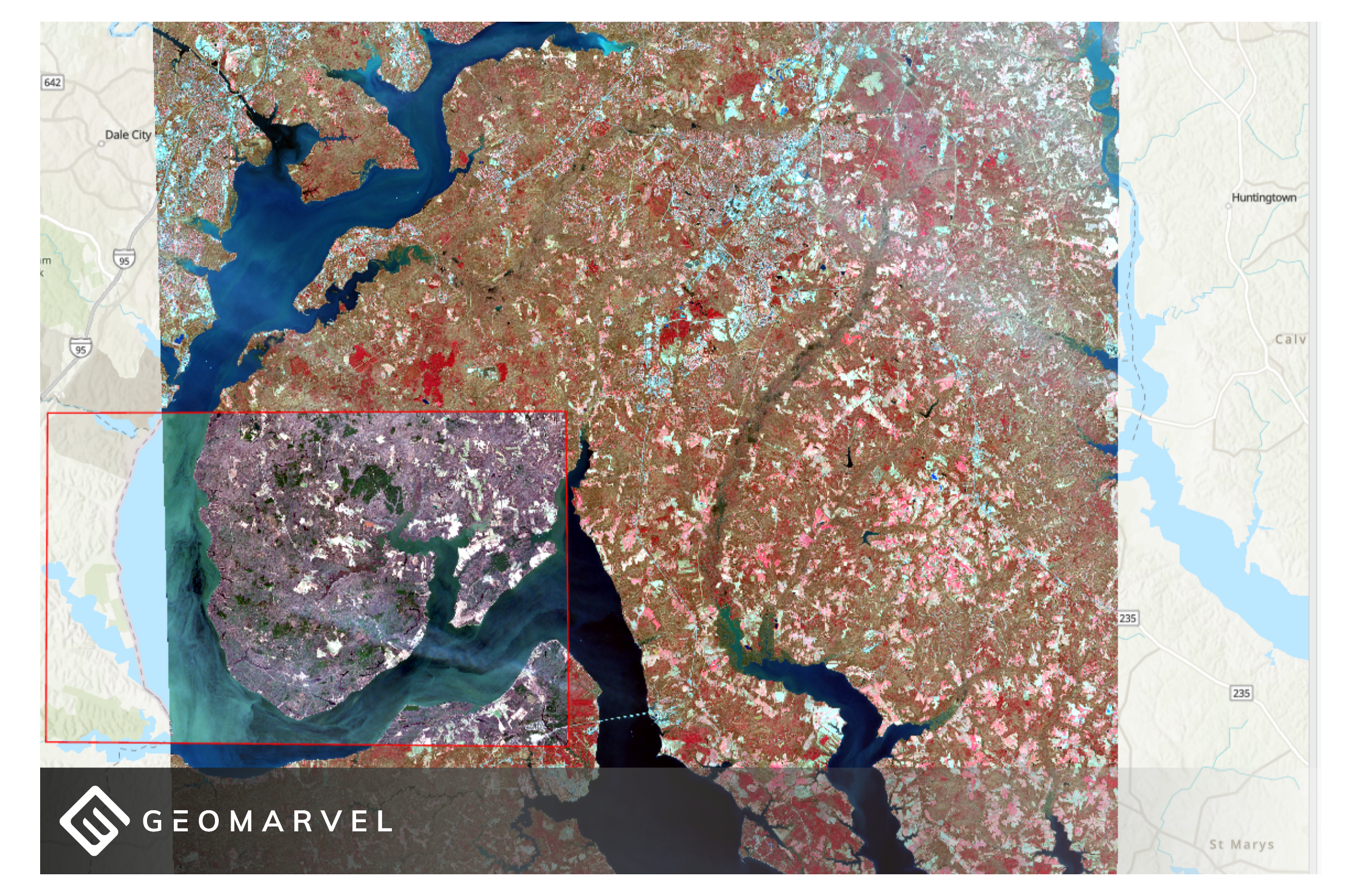
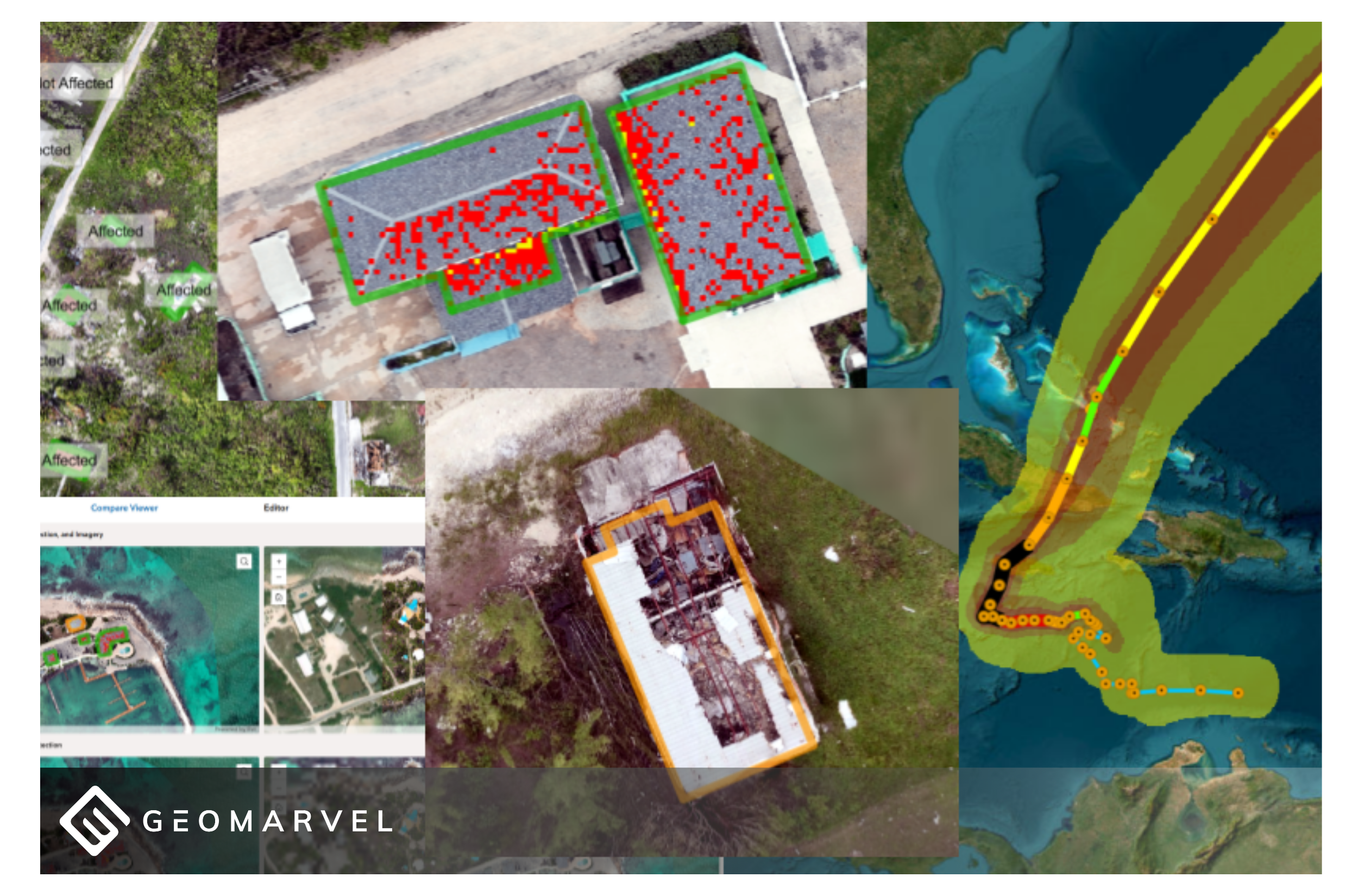
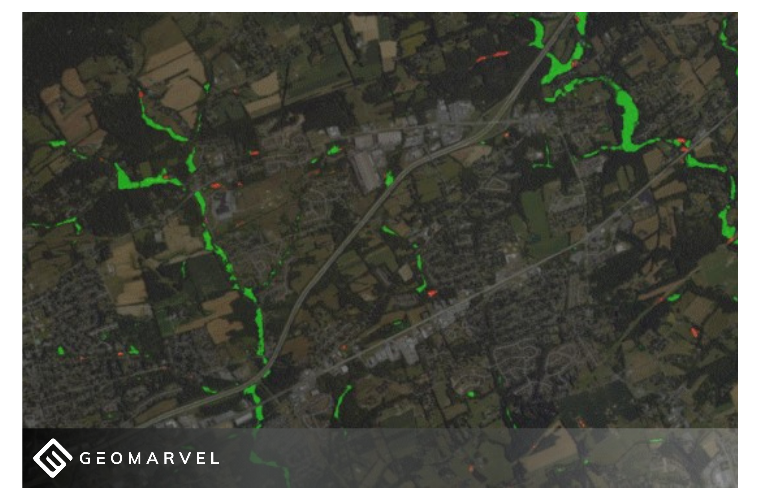
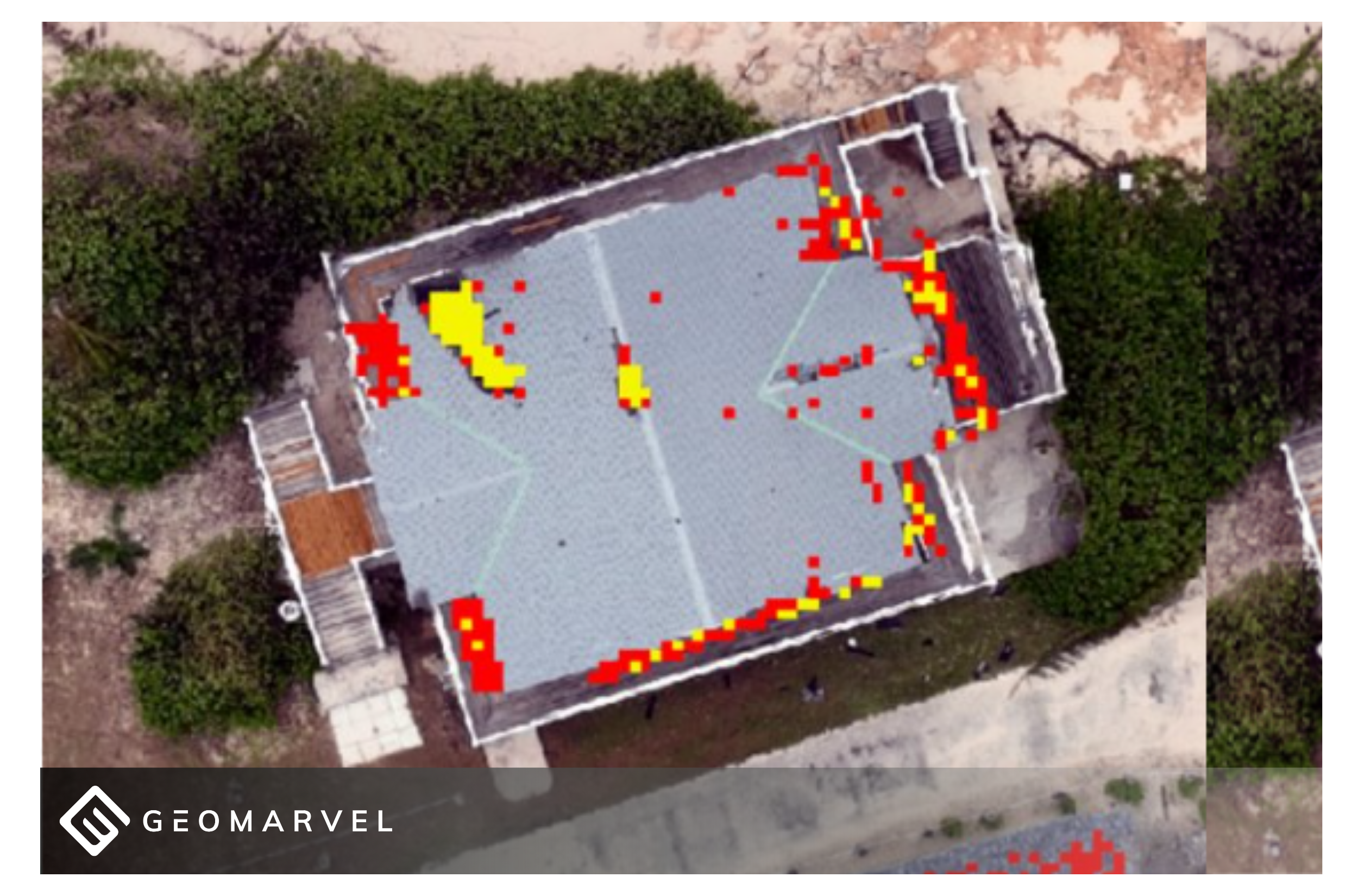
Imagery has evolved into a core input for operational and analytical workflows. Aerial, satellite, drone, and reality capture data now inform infrastructure planning, environmental monitoring, emergency response, and asset management. Organizations increasingly rely on imagery to detect change, monitor conditions, and support data-driven decisions.
GeoMarvel helps clients modernize their imagery strategies through cloud-enabled and hybrid architectures that prioritize scalability, governance, and performance. We design repeatable workflows that transform raw imagery into accessible, analysis-ready services—supporting time-based analysis, automation, & emerging GeoAI initiatives.
Our approach enables organizations to:
Esri’s Imagery Specialty provides customers with a clear indicator of partner proficiency in imagery architecture and raster analytics. As imagery datasets grow in size and complexity, organizations need experienced partners who can design resilient systems aligned with enterprise IT and GIS strategies.
Earning this designation differentiates GeoMarvel as a trusted advisor capable of integrating imagery into broader GIS and cloud ecosystems. We combine infrastructure design, data engineering, and application development expertise to ensure imagery environments are secure, performant, and built for long-term sustainability.
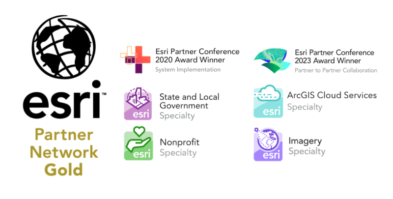
GeoMarvel’s journey with Esri began over ten (10) years ago through the Esri Startup Program. As advocates of “The Science of Where,” we continue to expand our expertise across the ArcGIS platform. Over time, we have earned multiple specialty designations, including ArcGIS System Ready, ArcGIS Cloud Services, ArcGIS Hub, Nonprofit, & State & Local Government Specialties.
With the addition of the Imagery Specialty, organizations can confidently engage GeoMarvel to design, implement, & sustain enterprise imagery and raster analytics solutions that elevate GIS capabilities across their operations.
GeoMarvel LLC is a software development company and Gold Tier Esri Business Partner based in the Washington, D.C. area. We specialize in GIS-focused workforce optimization, cloud infrastructure, data analysis, computation, and custom application and data visualization development. To learn more about our products and services, explore our vast portfolio of entities ranging from the Fortune 500 list, international non-profits and disaster relief organizations, to large electric utility companies, local governments, and startups.

Our team of GIS systems experts are fully equipped to aid your organization with all of your ArcGIS Enterprise implementation and migration needs, from on-prem to cloud infrastructure, we’re here to help you keep in line with industry best practices and to ensure a healthy & fully operational GIS system to support your critical workflows. We offer a variety of service packages, including the building of GIS cloud infrastructures, cloud hosting strategies, technical consulting, Managed Services, and much more. Here at GeoMarvel, we are committed to providing our clients with comprehensive GIS support and knowledge transfer, to empower them with complete GIS systems to achieve their goals!