We recently developed NomadIQ’s #mobileapplication that provides users with curated #remotesensing data layers to explore the world around them. Click to read more about the app’s development, architecture, and amazing features!


We recently developed NomadIQ’s #mobileapplication that provides users with curated #remotesensing data layers to explore the world around them. Click to read more about the app’s development, architecture, and amazing features!
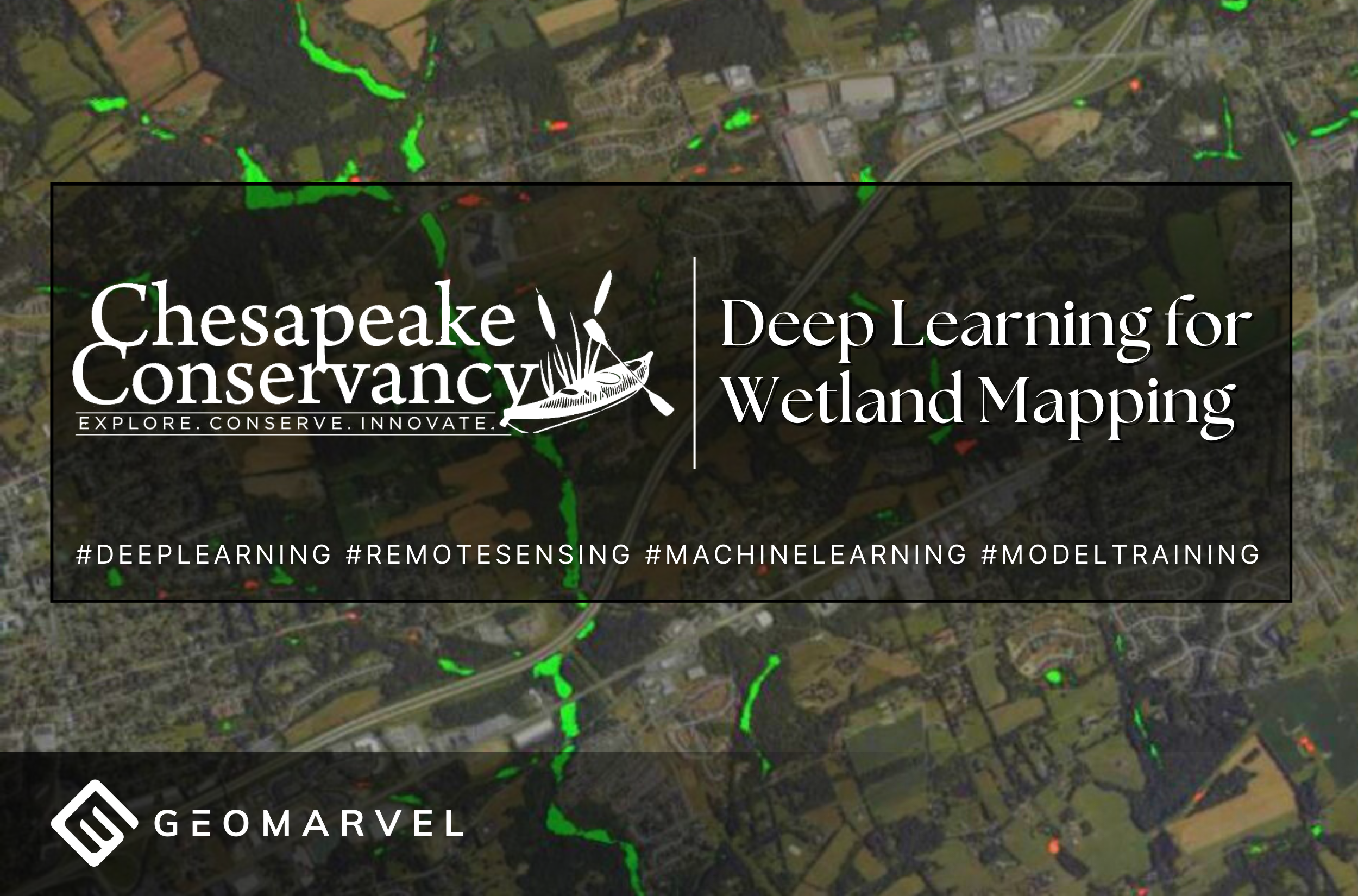
The GeoMarvel was honored to partner with Chesapeake Conservancy to operationalize #deeplearning workflows for high resolution wetlands #mapping to support the preservation & protection of the Chesapeake Bay wetlands & the species that live there. Learn more in our latest portfolio! #machinelearning #remotesensing #modeltraining
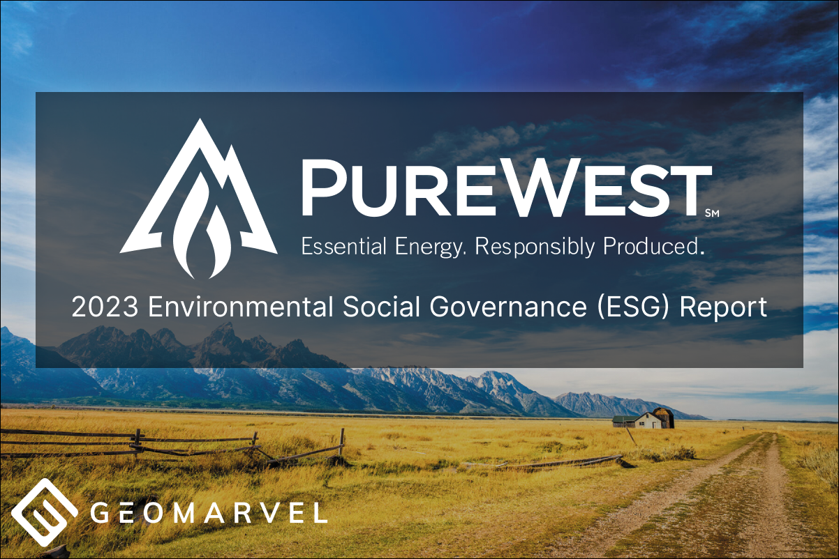
We are proud to have supported PureWest Energy again in 2024 with bringing their 2023 ESG Report to life utilizing ArcGIS StoryMaps. Take a look at their continued sustainability efforts& advancements in data & technology to support corporate social responsibility.
We are thrilled to welcome Carolyn Gamble to the GeoMarvel team as our new Associate Director of Services! Carolyn will support our Professional Services team with her project management expertise & also support with business development initiatives.
Get to know Carolyn better with our latest Team Spotlight!

We are so excited to share the GIS projects devised by our two GeoMarvel Technical Interns for 2024 using ArcGIS technology, Aubree High and Latoya Jackson. Read their reports on our blog and watch the highlight videos on our Youtube channel!
We are so excited to introduce Grant Adams as the newest member of our Managed Services team! Grant has joined our team as a Solutions Engineer and will support with designing, developing, & implementing innovative GIS solutions that enhance spatial data insights. Get to know Grant better with our latest Team Spotlight!
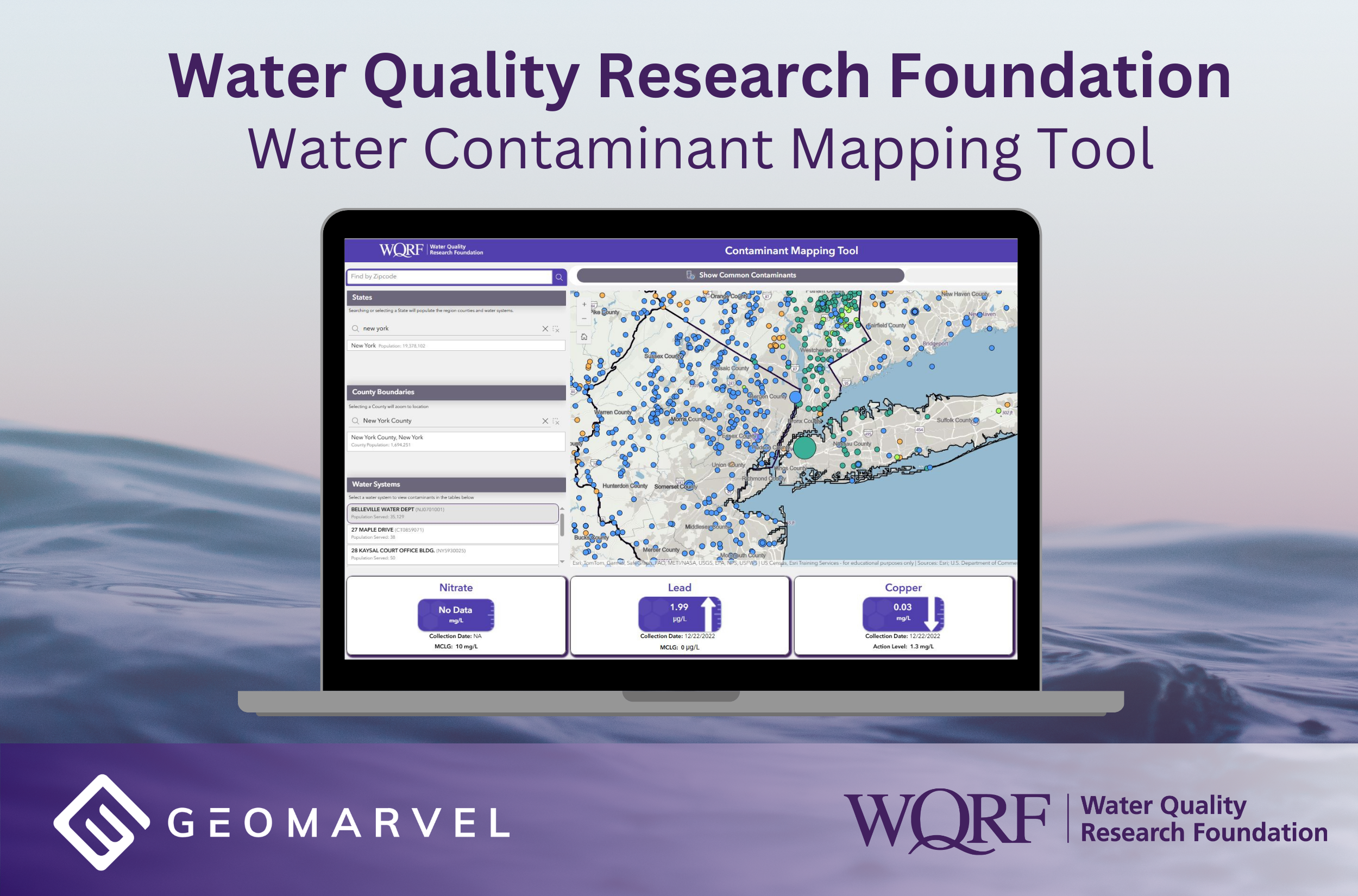
GeoMarvel partnered with the WQRF on the Water Contaminant Mapping Tool, which uses ArcGIS ExperienceBuilder to visualize contamination in public drinking water systems which serve nearly 88% of the U.S. population.
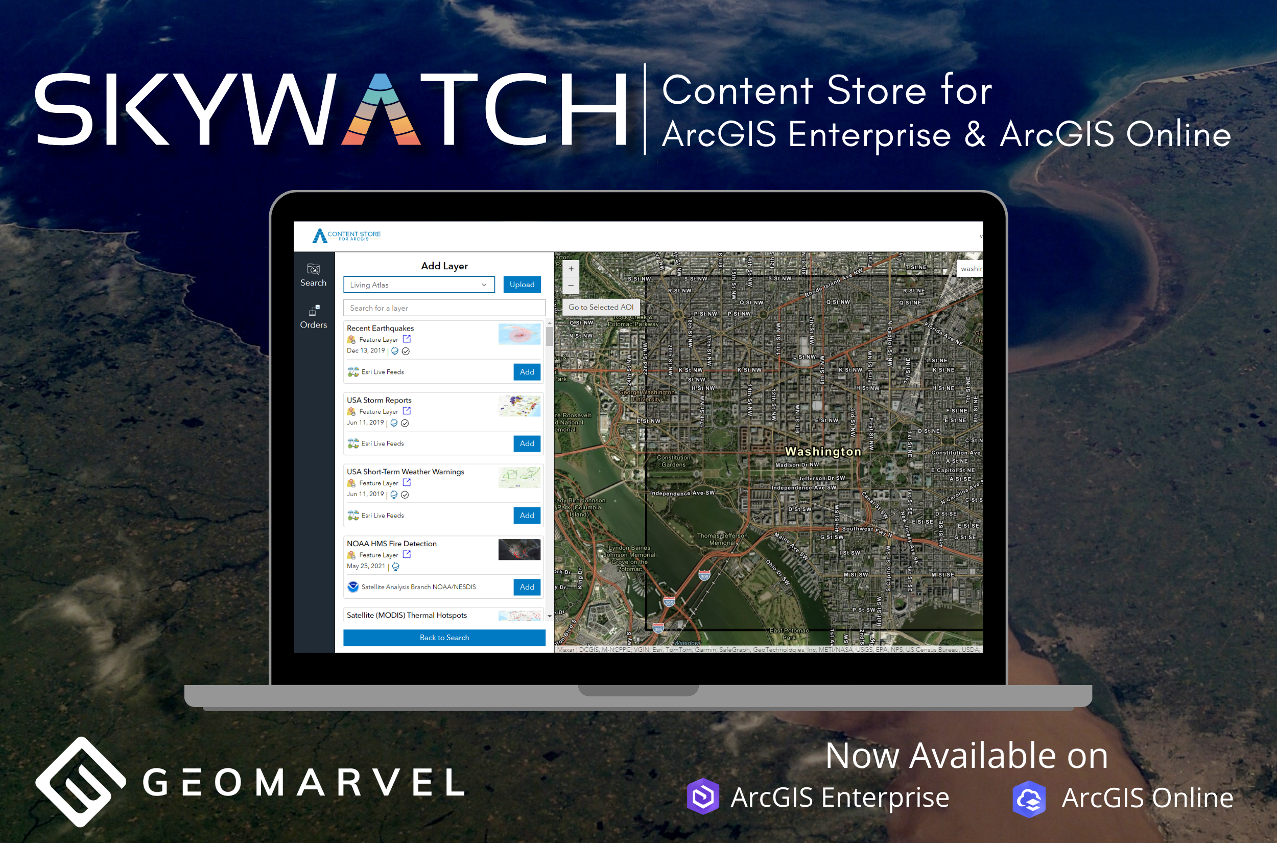
We are excited to announce our recent partnership with SkyWatch where together we developed the SkyWatch Content Store, a new web application designed to enhance the discovery, purchase, & use of premium satellite imagery within ArcGIS Online & ArcGIS Enterprise.
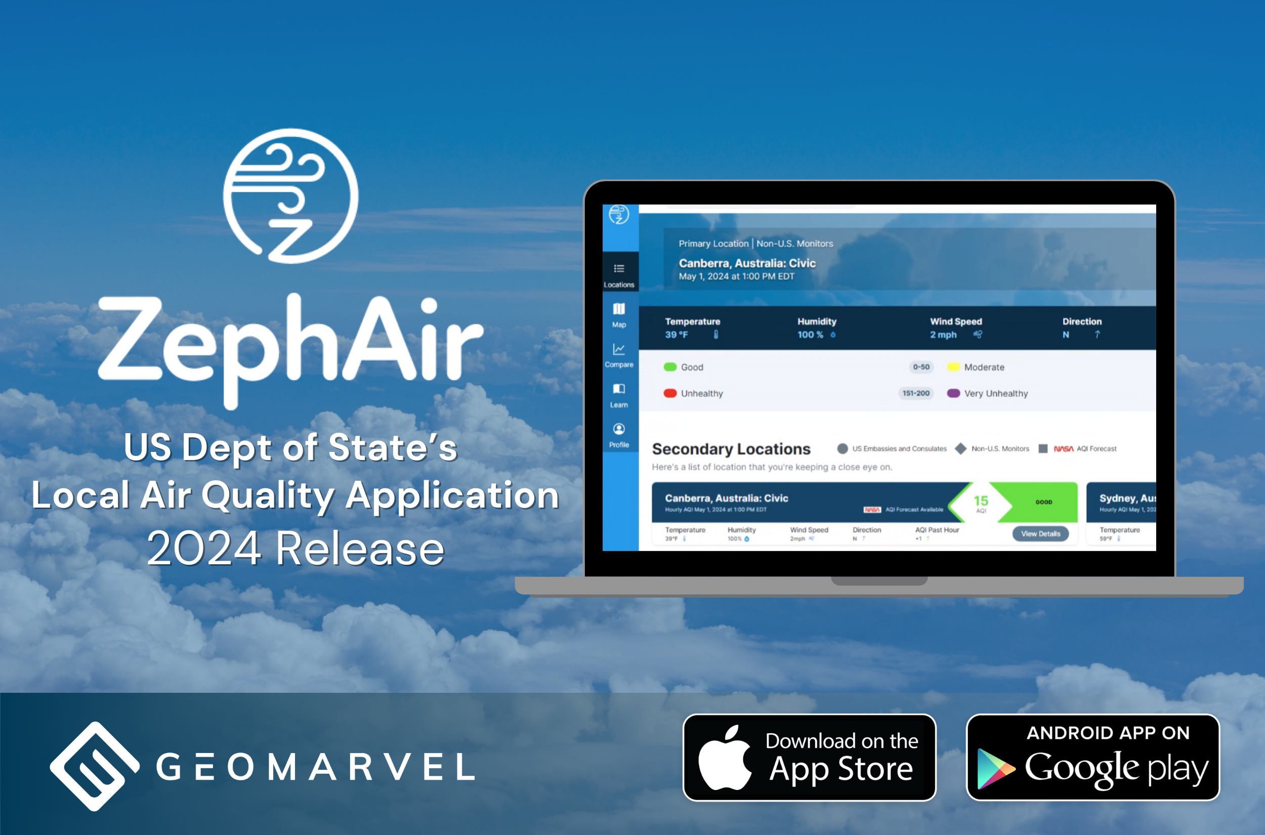
GeoMarvel partnered with the US Department of State’s Greening Council and Greening Diplomacy Initiative (GDI) to develop ZephAir, a mobile application that provides users with hourly data and alerts for local Air Quality (AQI).
Please help us in welcoming Alex Campbell to the GeoMarvel team! Alex has joined our team as a GIS Developer and will provide web & application development as well ArcGIS Enterprise insights to our Managed Services team. Learn more about him in our latest Team Spotlight!