SkyWatch Content Store August 2024 Release
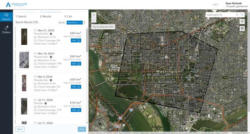
GeoMarvel partnered with SkyWatch Space Applications Inc (also known as SkyWatch) to develop the SkyWatch Content Store for ArcGIS Online and Enterprise, a new web application designed to enhance the discovery, purchase, & use of premium geospatial content within the ArcGIS ecosystem. Announced at the July 2024 Esri User Conference, this tool integrates deeply with ArcGIS Online to deliver a high-quality user experience.
As part of the Esri Partner Network, SkyWatch leverages its extensive knowledge of the Esri platform to streamline access to geospatial content. Released to the public in August 2024, the Content Store allows users to authenticate with ArcGIS credentials, search for content using existing layers, and publish imagery layers for easy sharing and analysis.
Initially, the Content Store will feature high-resolution archive data from providers such as Airbus, Planet, Satellogic, and Urban Sky, with future plans to include tasking, vector content, and derived data products. It is supported by the SkyWatch platform, which manages ordering, payments, identity, policy enforcement, and location services.
Sign in to SkyWatch Content Store using your existing ArcGIS credentials.
SkyWatch collaborated with data providers to reduce minimum area requirements, making your data purchases more budget-friendly so users can pay for the data they actually need.


Users have access to 10-70cm resolution data from top geospatial content providers like Airbus, Planet, Satellogic, and Urban Sky, all under one unified license agreement.
Define your search area by searching for and importing existing ArcGIS map layers from My Content, My Organization, and Living Atlas.
Data is delivered directly to your ArcGIS Online account as a Dynamic Imagery Layer (via Esri Image Dedicated services), ready for sharing and analysis within your ArcGIS environment.

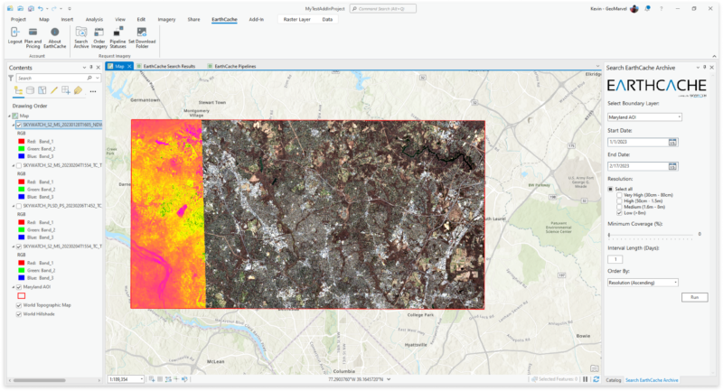
Access content purchased from the Content Store within the EarthCache Add-In for ArcGIS Pro, and vice versa.

SkyWatch’s mission is to empower customers by enabling them to harness geospatial data for solving their most critical business challenges. They are committed to making remote-sensing data accessible to everyone through a straightforward user experience. In the past year alone, they’ve supported over 7,500 active organizations, utilized over 700 sensors, delivered more than 12 million km² of data, & processed over 8 million API calls.
Does your organization need help bringing your mobile or web application to life? Look no further than GeoMarvel! Our team of industry experts are here to assist you every step of the way. Don’t hesitate to contact us to discover how GeoMarvel can elevate your organization to new heights!