GeoMarvel was pleased to host two interns this summer for the GeoMarvel Technical Internship!
Over the course of 12 weeks, our interns were given the opportunity to gain experience working alongside & receiving mentorship from our own team of experts, gain practical hands-on experience with ArcGIS software & technologies, and select their own areas of focus for a real-world GIS project. At the conclusion of the internship, interns were given the opportunity to present their project to the broader GeoMarvel Team and answer the team’s questions.
We are so pleased to share their hard work in today’s blog & the above GeoMarvel Live! video.


Aubree graduated from Pennsylvania State University in May 2024 with a BS in Earth Sciences & a Minor in Geographical Information Sciences (GIS). She has a strong background in Python & was excited to contribute her knowledge in this area her challenging internship topic.
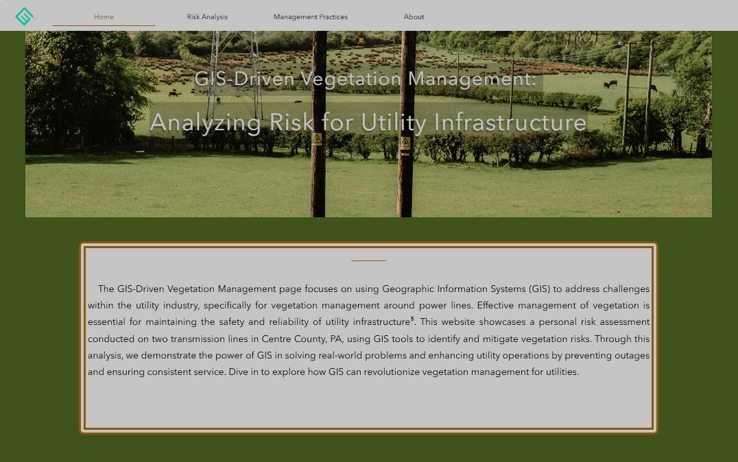
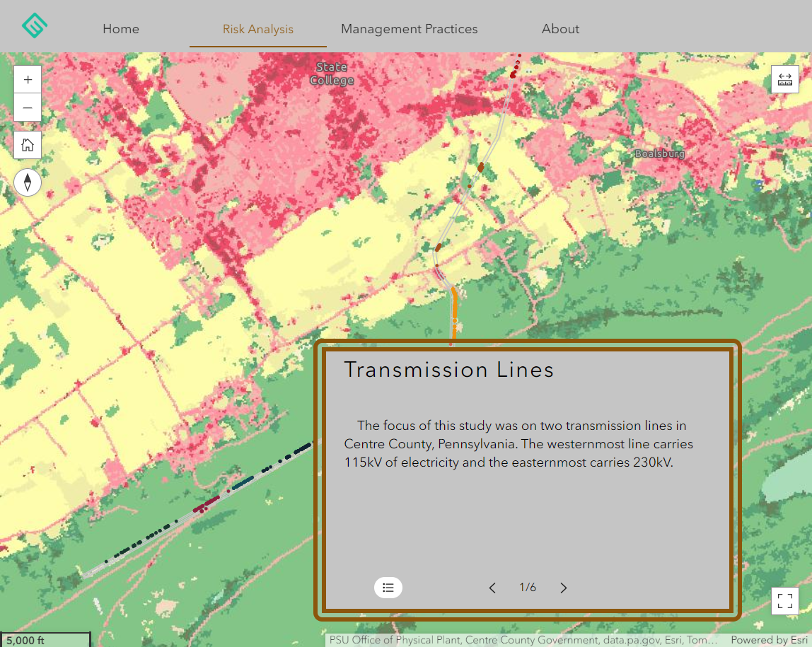
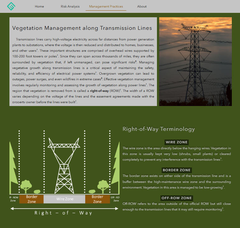
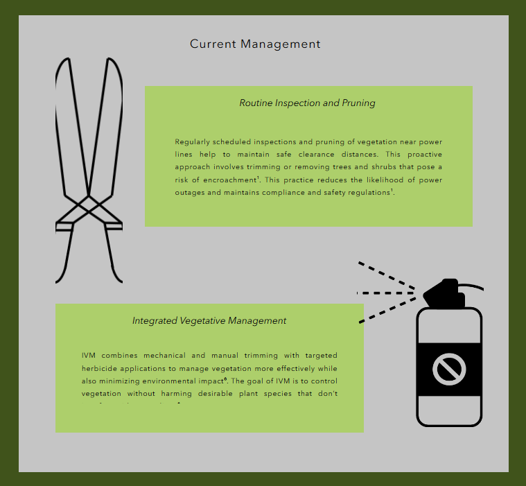
Aubree focused on the utility industry and the topic of effective vegetation management along transmission lines to ensure uninterrupted power supply and mitigate risks like outages or wildfires. Vegetation management involves monitoring and maintaining clearance around power lines, known as right-of-ways (ROWs). In her report, she used GIS and LiDAR technologies to assess the risk of vegetation encroaching on transmission lines in Centre County, Pennsylvania. By analyzing high-resolution LiDAR data and generating canopy height models, her study identifies and maps areas of high and medium risk based on tree proximity to the power lines. This information can be leveraged to prioritize maintenance and resource allocation, ultimately aiming to reduce power outages and repair costs.
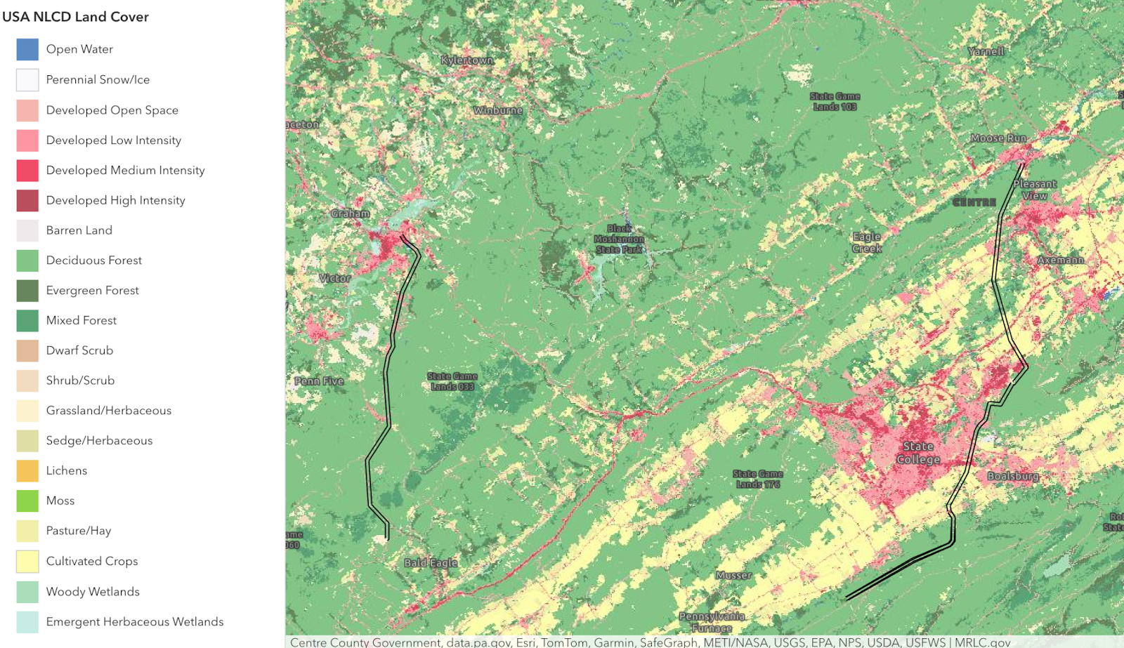
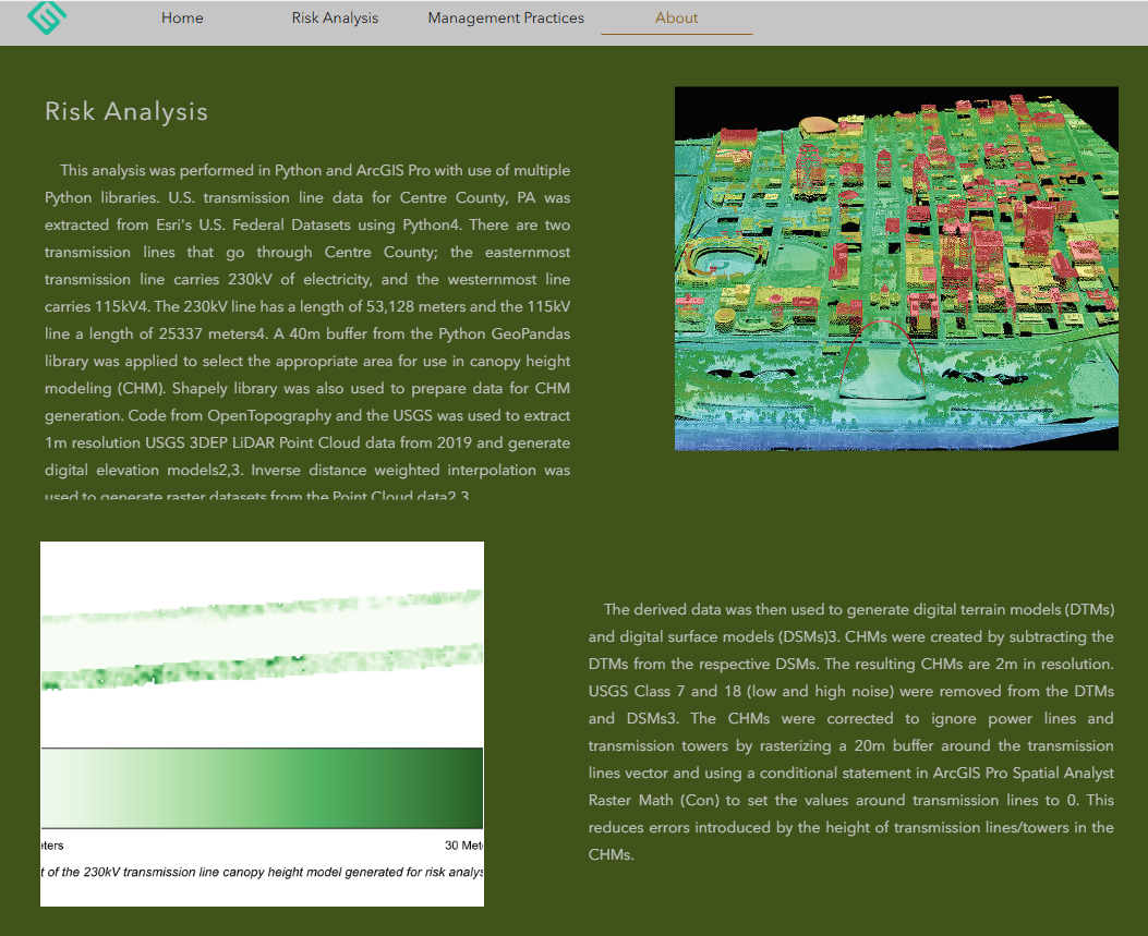
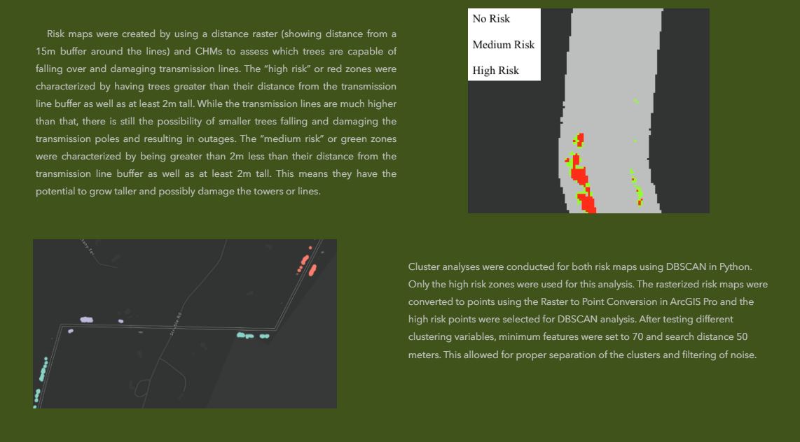
The results reveal that the 115kV transmission line has a higher proportion of high-risk zones compared to the 230kV line, which may be attributed to less frequent maintenance and more forested areas along the 115kV route. The GIS-based risk maps and clustering analysis demonstrate how vegetation risk varies spatially, with significant implications for vegetation management strategies. The study concludes that integrating GIS and LiDAR technologies can enhance the efficiency of managing vegetative risks, offering utility companies a cost-effective approach to maintaining a reliable power supply and improving service quality for the public.
To visualize this, Aubree used ArcGIS ExperienceBuilder to create a web application that shows vegetative risk around power lines, allowing users to explore the entire area in scope for this study. She leveraged ArcGIS API for Python for data processing and manipulation & ArcGIS Online for the actual map development, design, and deployment.
Latoya graduated from Liberty University in Virginia with a BS in Biology with a concentration in Environmental Science and has also gained experience through work & internships in GIS.


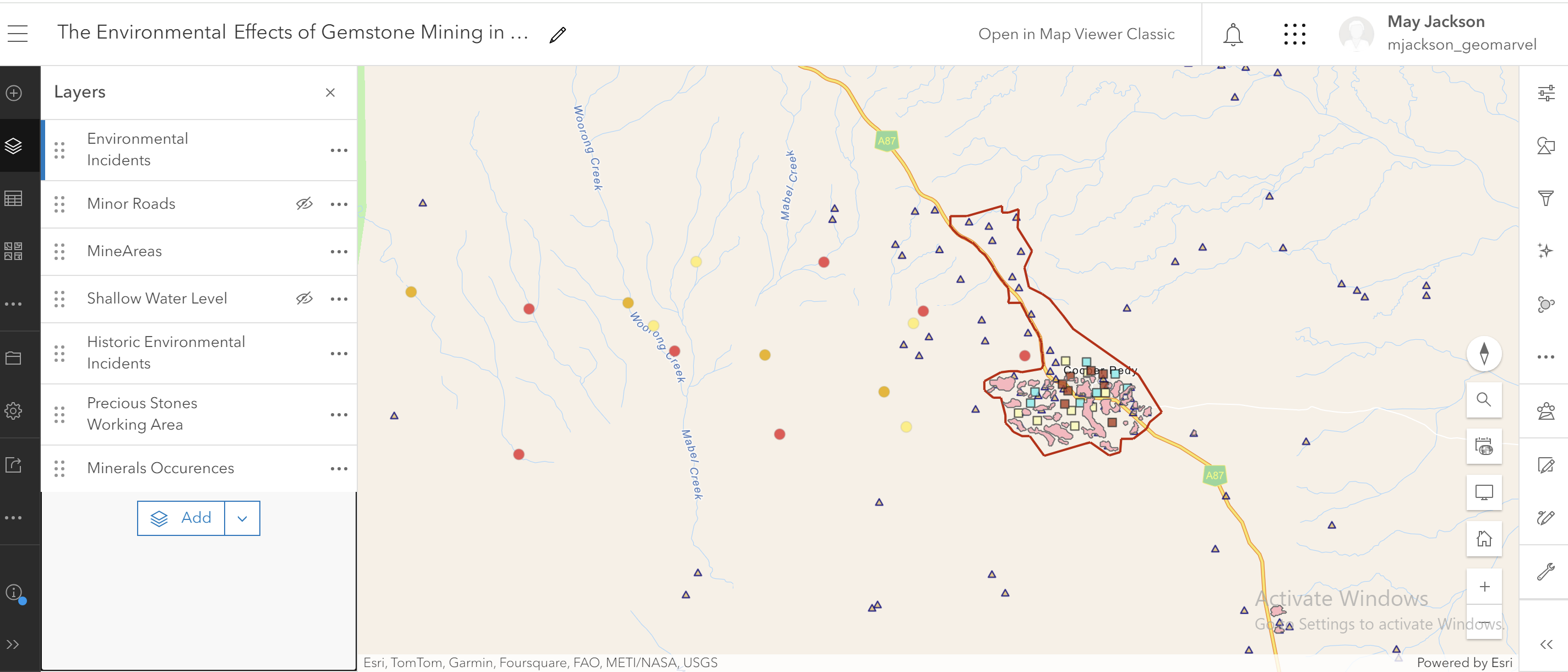
Latoya explored the environmental challenges faced by Coober Pedy, Australia’s premier opal mining region, which is grappling with chemical contamination from extensive mining operations. Mining activities, both underground and open-cut, introduce heavy metals and pollutants into the environment, jeopardizing groundwater quality and local ecosystems. The Old Timers Mining Company in South Australia seeks effective solutions to address these contamination issues.
Data sources for this assessment included Australian Government environmental databases, historical mining records, and real-time water quality data. Her methodology involved setting objectives to mitigate contamination, collecting baseline data, performing GIS mapping to identify contamination hotspots, and developing targeted mitigation strategies.
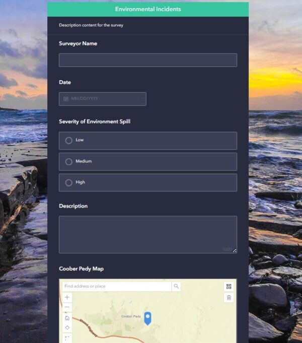
Her report emphasized ongoing field surveys and data validation to assess the effectiveness of remediation efforts with the goal of protecting aquatic ecosystems, ensuring clean water availability, and enhancing environmental health around Coober Pedy. Several ArcGIS applications were used to help monitor and manage contamination. Key steps include overlay analysis to map contamination levels, using ArcGIS Survey123 for field data collection, and employing ArcGIS Dashboards for real-time monitoring of contaminants.
Are you seeking professional support or GIS consulting for your organization? Look no further than GeoMarvel. Our dedicated team is here to fulfill all your geospatial needs. Whether it’s application development or managed services, our team of industry experts are here to assist you every step of the way. Don’t hesitate to contact us to discover how GeoMarvel can elevate your organization to new heights!
")