GeoMarvel was proud to partner with NatureServe in the development of InSite, a custom, map-focused reporting platform designed to deliver accurate, on-demand geospatial insights. The project combined careful architecture, intuitive user experience design, and robust application development to create a scalable, high-performance solution tailored to users’ needs.
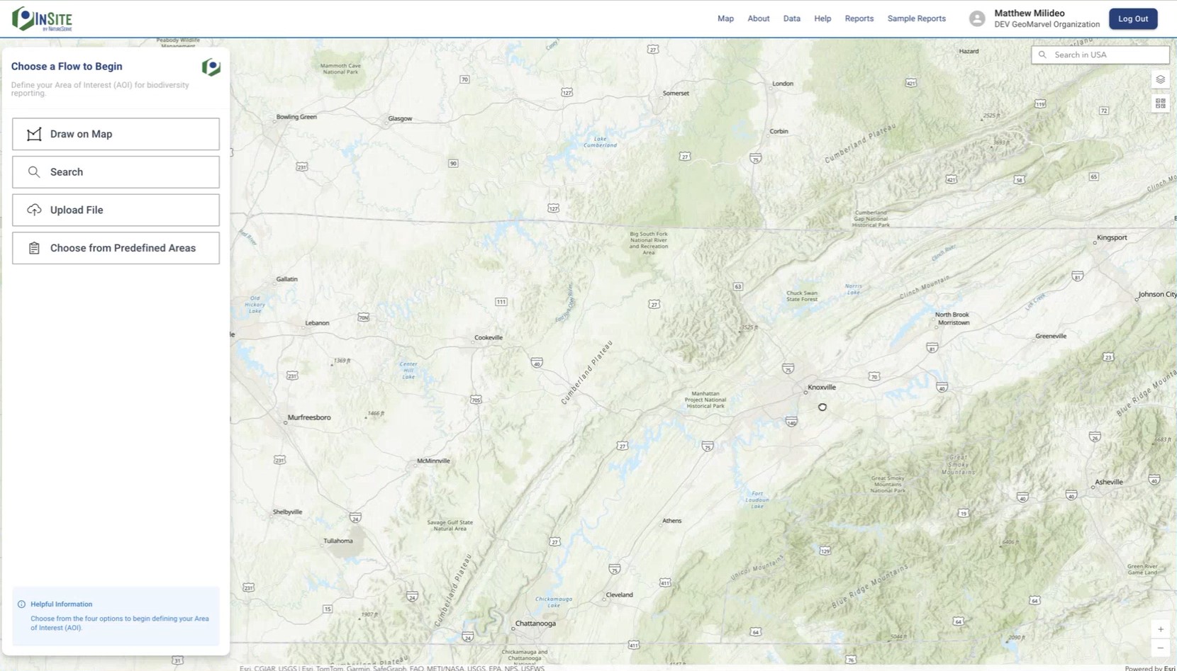
Designed to help organizations and decision-makers explore the ecological value of any site, InSite provides fast, reliable scores for key metrics such as species extinction risk, ecosystem vulnerability, and overall ecological condition. Built for ease of use, the tool requires no GIS expertise—users simply draw or upload a site to instantly access detailed biodiversity insights.
The platform brings together two key components: the InSite store, which handles payments and organization management, and the InSite report generation tool, which enables users to create map-based reports and export them as PDFs. Users can operate individually or as part of an organization, sharing entitlements or credits through a combination of authentication and the app’s own logic.
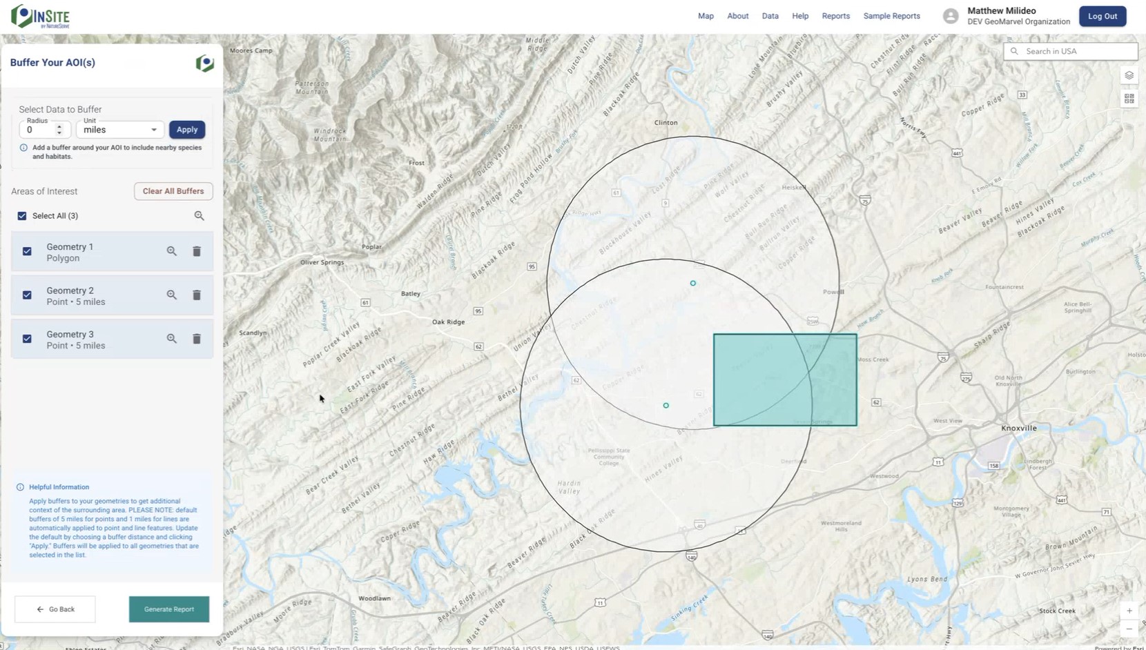
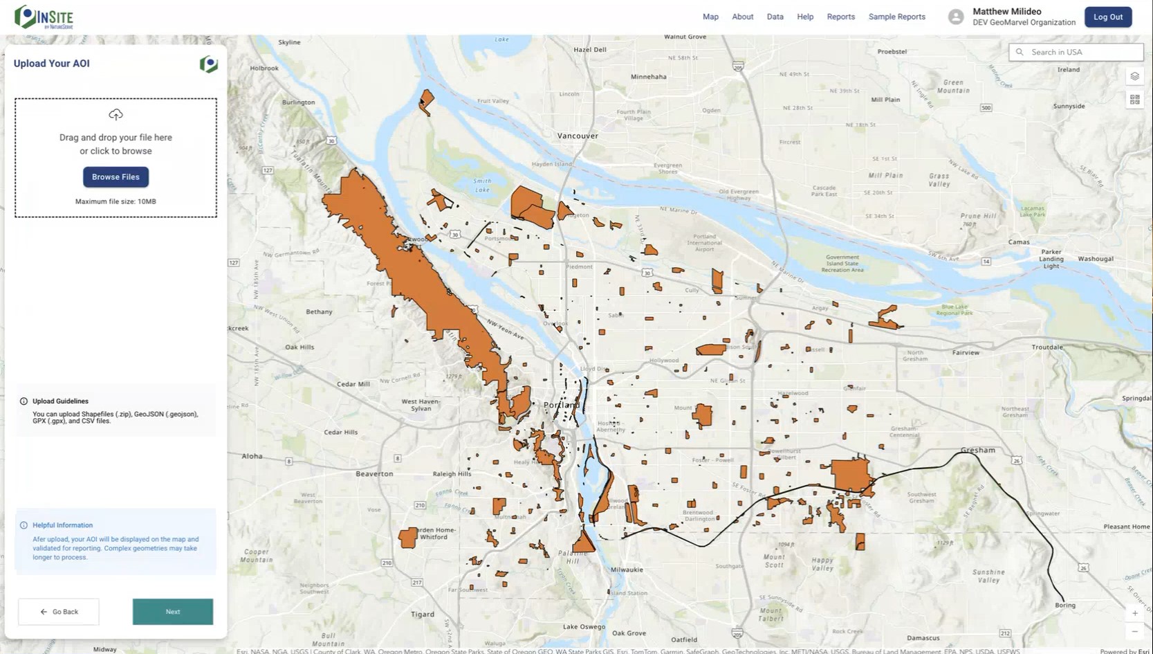
Report generation is designed for flexibility and precision. Users can define areas of interest by drawing polygons, entering points with automatic buffering, searching for locations manually, or uploading Shapefiles and GeoJSON files. Backend API services handle geoprocessing and PDF creation, ensuring that complex scientific data is accurately formatted. Thoughtful design considerations, such as page breaks and print-ready layouts, make the reports data-rich yet easy to read and share.
From a development perspective, InSite emphasizes robust data handling and close collaboration with scientific teams. The reporting tool and outputs were built simultaneously, requiring careful coordination to transform raw data into a digestible format. Iterative design ensures usability for both individual users and organizational workflows, while comprehensive documentation and standard dev/production environments support maintainability and future enhancements.
InSite empowers data-driven decision-making across business, conservation, and sustainability applications. Whether screening for potential risks, comparing multiple locations, or generating credible inputs for sustainability reporting, the platform provides clear, comparable biodiversity intelligence that helps guide planning and investment decisions. Its insights are grounded in NatureServe’s 50 years of trusted science, supported by a network of over 60 programs tracking 100,000 species and ecosystems across more than 1,000,000 mapped locations.
The application is built to connect users with local expertise through the NatureServe Network, aligning with international frameworks such as The Taskforce on Nature-related Financial Disclosures (TNFD)’s State of Nature measures. By linking comprehensive biodiversity data with local knowledge, InSite ensures that users can make informed, practical decisions while connecting to resources for the next steps in conservation or risk mitigation.
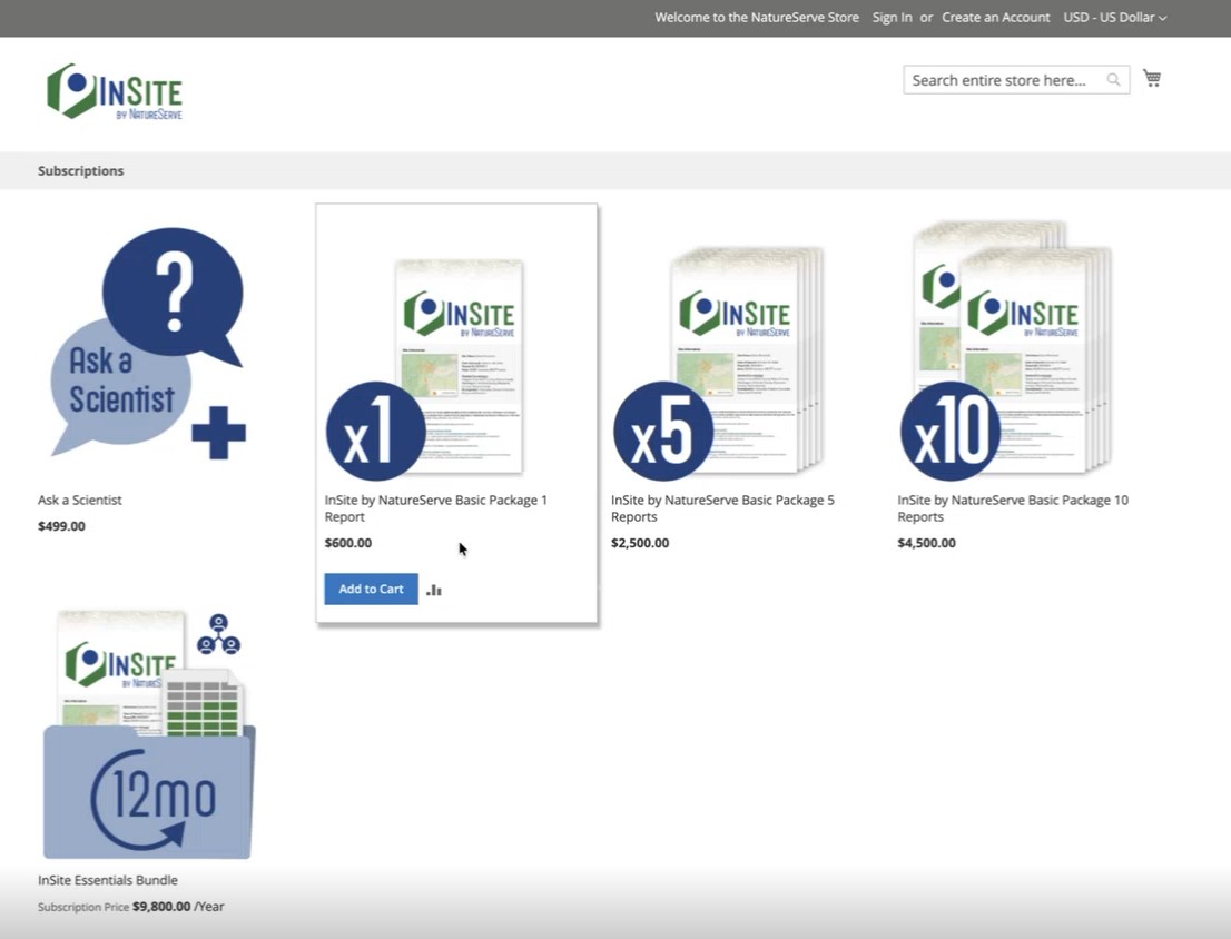
InSite by NatureServe offers flexible access to biodiversity intelligence—available as single reports, discounted bundles of 5 or 10, or through an annual subscription. No matter the option, users can leverage InSite reports in many impactful ways:


For over 50 years, NatureServe has been the authoritative source for biodiversity data across North America. As the hub of a powerful network of more than 60 governmental and nonprofit programs & nearly 1,000 conservation professionals, NatureServe collects, analyzes, and delivers trusted biodiversity information to guide effective conservation action.
The organization leverages the power of science, data, and technology to advance biodiversity conservation and stewardship, with a vision for a world where the best available science informs every conservation and land-use decision—ensuring that biodiversity not only survives but thrives. Through the NatureServe Network, the organization provides essential data and expertise that help land managers, policymakers, and organizations protect vulnerable species and ecosystems. From preventing biodiversity loss to shaping sustainable development, NatureServe’s work empowers better decisions for the planet’s most at-risk natural places. Building on a conservation legacy that began in 1974 with the establishment of the first state natural heritage program, NatureServe continues to uphold a half-century of leadership in delivering credible, science-based insights for conservation across the U.S., Canada, and beyond.
Is your organization ready to bring a web application idea to life? Or perhaps you’re seeking other Professional GIS Services? Explore all of our professional services, and read up on our past successes outlined in our diverse portfolio. Reach out to our industry experts to start a conversation about your unique needs today.