
ParGo AI is modernizing how organizations access and use property and location intelligence. Their mission centers on simplifying complex, fragmented data by bringing together nationwide property information, advanced geospatial capabilities, and the power of AI into one intuitive platform. By removing barriers to high-quality spatial analysis, ParGo enables professionals across industries to make faster, clearer, and more informed location-based decisions.
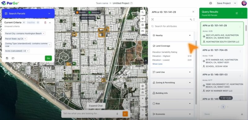
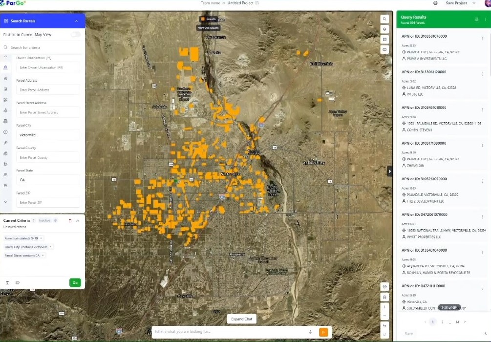
The company’s roots trace back to early work in 2019, with ParGo AI, Inc. formally founded in 2024. Since then, the team has grown into a diverse group of experts spanning GIS, real estate, finance, development, and technology. Their platform—launching in 2025—offers a unified, web-based environment where users can explore and analyze parcels, zoning, ownership, environmental considerations, and other key datasets at a national scale. AI-driven analytics and streamlined tools make it possible to surface insights quickly without requiring deep geospatial expertise.
Supported by strong data, technology, and channel partnerships, ParGo continues to expand the capabilities of its solution. The result is a next-generation property intelligence platform that empowers users to identify opportunities, reduce risk, and approach land and real estate decisions with greater confidence and efficiency.
GeoMarvel partnered with ParGo AI to design & implement a cloud-native spatial data architecture capable of handling massive geospatial datasets, supporting AI workflows, & scaling as the platform grows. The solution replaced legacy systems with a high-performance data lake (a centralized repository for storing raw and diverse data at scale), improving data ingest speeds, streamlining updates, and reducing operational costs. This modernized infrastructure positions ParGo for long-term growth, advanced analytics, and better decision-making.
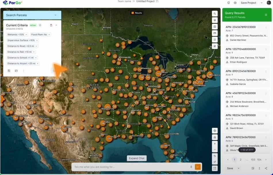
This implementation gives ParGo a flexible, efficient, and scalable data infrastructure, enabling modern location intelligence workflows and supporting continued innovation in property and geospatial analytics.
Is your organization ready to bring a web application idea to life? Or perhaps you’re seeking other Professional GIS Services? Explore all of our professional services, and read up on our past successes outlined in our diverse portfolio. Reach out to our industry experts to start a conversation about your unique needs today.