As organizations increasingly depend on Geographic Information Systems (GIS) to support daily operations, informed decision-making, and essential services, maintaining a healthy and high-performing GIS environment has never been more important. Behind every reliable map, application, and spatial data service is an infrastructure that requires ongoing attention, optimization, and oversight.


Esri’s ArcGIS Monitor gives organizations the visibility they need to understand, manage, and improve their ArcGIS Enterprise environments. By collecting and analyzing performance metrics across GIS infrastructure, ArcGIS Monitor helps teams identify potential issues, understand resource utilization, evaluate system performance, and make informed decisions about their technology investments.
For the City of Opelika, Alabama, ArcGIS Monitor has become an important part of that process. What began as an effort to improve system monitoring and visibility has evolved into a valuable resource for identifying performance bottlenecks, optimizing infrastructure, and making data-driven improvements that directly benefit the organization’s GIS operations and users.
ArcGIS Enterprise environments are made up of interconnected components, including ArcGIS Server, Portal for ArcGIS, data stores, databases, and supporting infrastructure. When these components experience performance issues or resource constraints, the effects can extend across applications, services, and the users who depend on them.
ArcGIS Monitor provides a centralized view of this complex environment, collecting meaningful performance data and presenting it through configurable dashboards, reports, metrics, and alerts. Rather than relying solely on user feedback or troubleshooting issues after they occur, GIS administrators can use these insights to better understand how their systems behave over time.
From monitoring infrastructure health and tracking resource consumption to evaluating service performance and identifying emerging issues, ArcGIS Monitor helps transform system data into actionable intelligence. Its capabilities offer several important advantages for organizations looking to get more out of their GIS investments.
Understanding what is happening behind the scenes is the first step toward maintaining a reliable GIS environment.
ArcGIS Monitor provides insight into the health and performance of ArcGIS Enterprise components, allowing administrators to track system metrics, monitor service availability, and identify potential areas of concern. This visibility makes it easier to understand how individual components interact and how changes in one area may affect the broader environment.
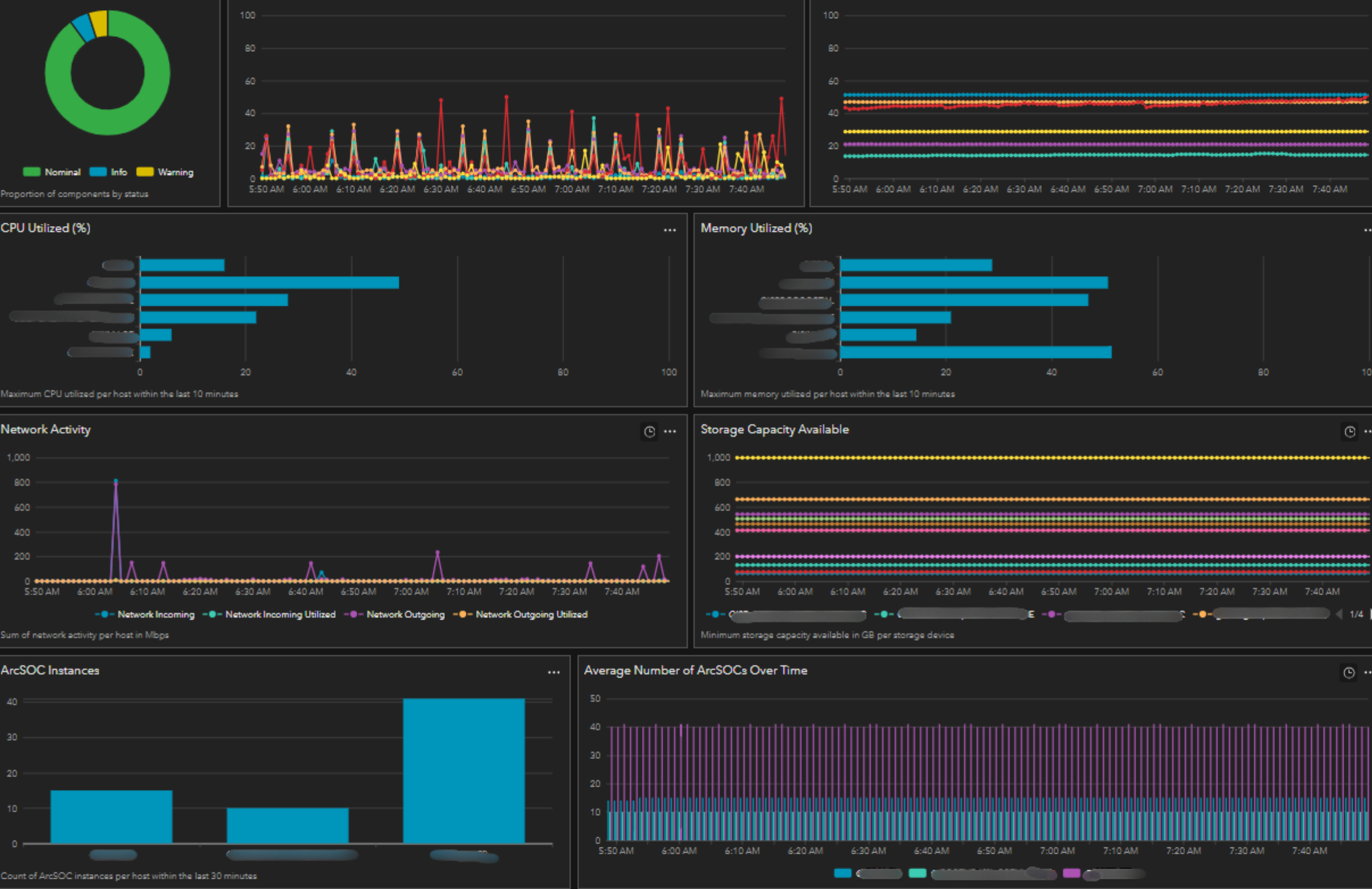
Performance issues are not always easy to pinpoint. Slowdowns may originate from application demands, server resources, database configurations, or the interactions between multiple system components.
ArcGIS Monitor helps organizations investigate these challenges by capturing performance metrics, tracking trends, and highlighting potential bottlenecks. With access to historical and real-time information, administrators can better understand when performance issues occur, what resources are affected, and where adjustments may be needed.
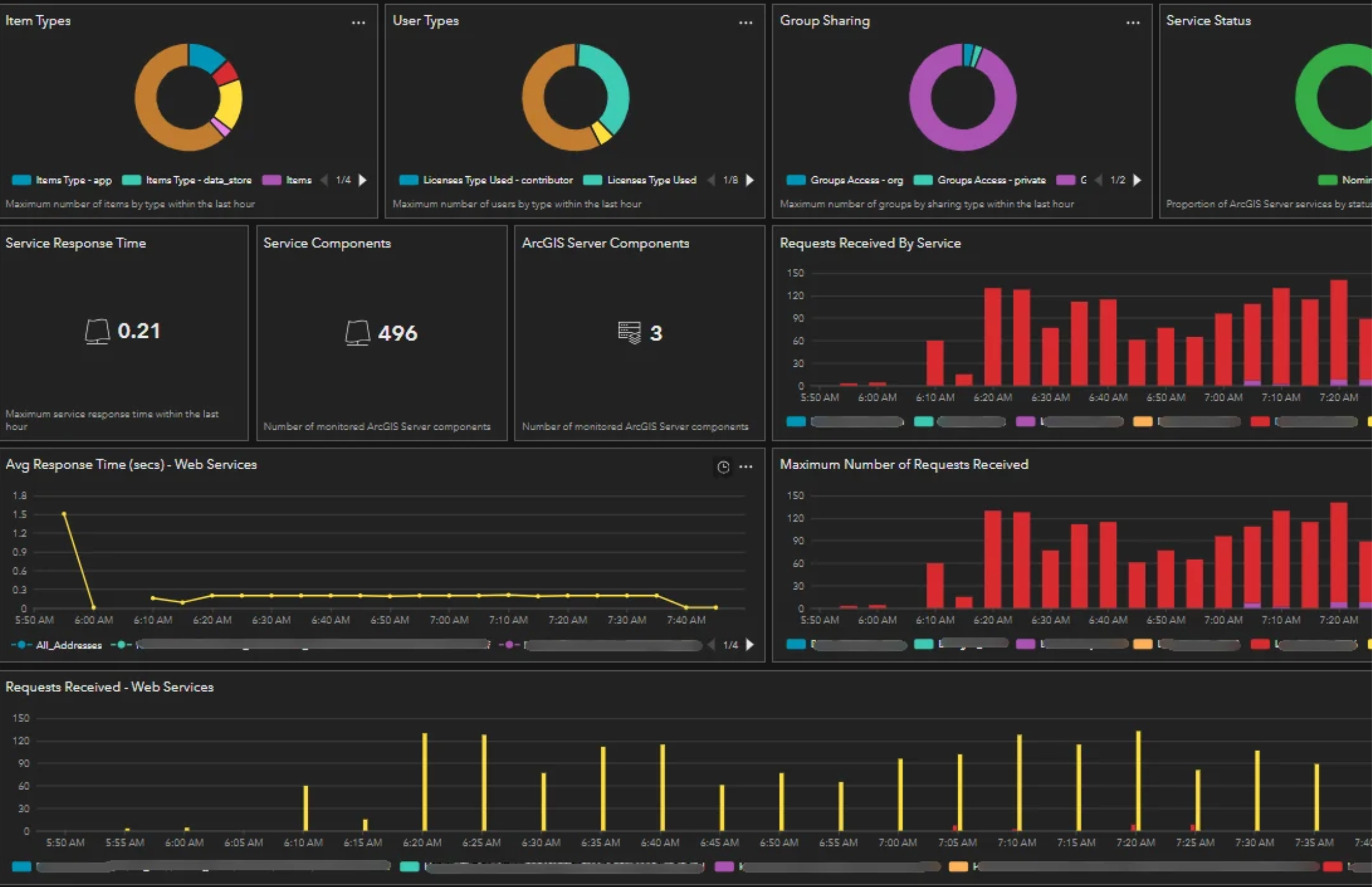
GIS infrastructure must be appropriately sized and configured to support changing workloads. Too few resources can create performance challenges, while unnecessary resources can increase operating costs without delivering additional value.
ArcGIS Monitor helps organizations evaluate how their infrastructure is being utilized, identify resource constraints, and better understand where capacity may need to be adjusted. These insights can support decisions around server allocation, memory and processing requirements, database performance, and future infrastructure investments.
When organizations lack sufficient system visibility, troubleshooting often begins only after a problem has affected users. This reactive approach can lead to longer investigation times, unnecessary disruptions, and recurring performance challenges.
ArcGIS Monitor helps change that approach by providing ongoing insight into system behavior, historical trends, and potential warning signs. With a better understanding of normal operating conditions, administrators can recognize unusual activity, investigate emerging concerns, and take action before smaller issues develop into larger problems.
Monitoring is not just about understanding what is happening today. Historical performance data can also help organizations anticipate future needs and make more informed infrastructure decisions.
By evaluating trends in system utilization, performance, and resource consumption, ArcGIS Monitor can help administrators establish performance benchmarks, assess capacity requirements, and identify areas that may require attention as GIS environments evolve.
These insights can inform infrastructure planning, system upgrades, resource allocation, and long-term technology strategies.
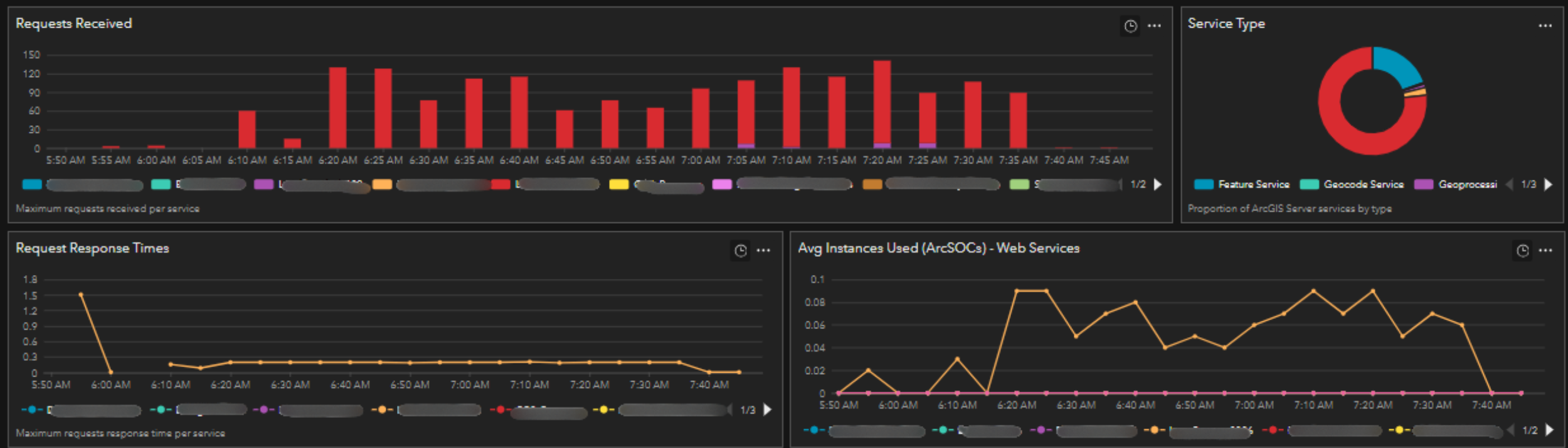

The return on investment isn’t simply in knowing how your GIS environment is performing. It’s in knowing what to do with that information.
The City of Opelika’s experience illustrates an important point: the true value of ArcGIS Monitor extends beyond collecting system metrics or displaying performance dashboards. Its greatest potential comes from what organizations can do with the information.
By improving visibility, identifying bottlenecks, optimizing resource utilization, and supporting more informed infrastructure decisions, ArcGIS Monitor helps organizations turn technical insights into meaningful operational improvements.
For Opelika, this meant identifying performance constraints during periods of high usage, making targeted adjustments to machine resources and SQL Server configurations, and seeing immediate improvements in system responsiveness.
It also reinforced the importance of combining the right technology with the knowledge and experience needed to interpret its findings and put those insights into action. The return on investment isn’t simply in knowing how your GIS environment is performing. It’s in knowing what to do with that information. As GIS environments continue to grow in complexity and importance, tools like ArcGIS Monitor offer organizations an opportunity to move beyond traditional system maintenance and embrace a more proactive, data-driven approach to infrastructure management.
With the right monitoring strategy, organizations can maximize the value of their existing investments, improve the reliability of their GIS services, and build a stronger foundation for whatever comes next.
GeoMarvel is proud to be counted among Esri’s ArcGIS Monitor expert service partners. GeoMarvel helps organizations monitor, manage, optimize, and maintain their GIS infrastructure through specialized ArcGIS Enterprise expertise and professional services.
Whether you’re looking to improve system visibility, investigate performance challenges, or develop a long-term infrastructure strategy, our team can help you turn GIS insights into action. Contact Us Today!