

The GeoMarvel team was honored to attend Esri’s 45th User Conference in San Diego this year! Our team was represented by Jon Nordling (CEO), Dalton Bloom (Director of Managed Services), Carolyn Gamble (Associate Director of Services), Molly Freeman (Principal Consultant), Grant Adams (Enterprise Solution Engineer), & Keith Ornbaum (Enterprise Solution Engineer). We’re excited to share our highlights with you!
Check out Esri’s playlist of Full Plenary Segments & Individual Demonstrations and Presentations below:

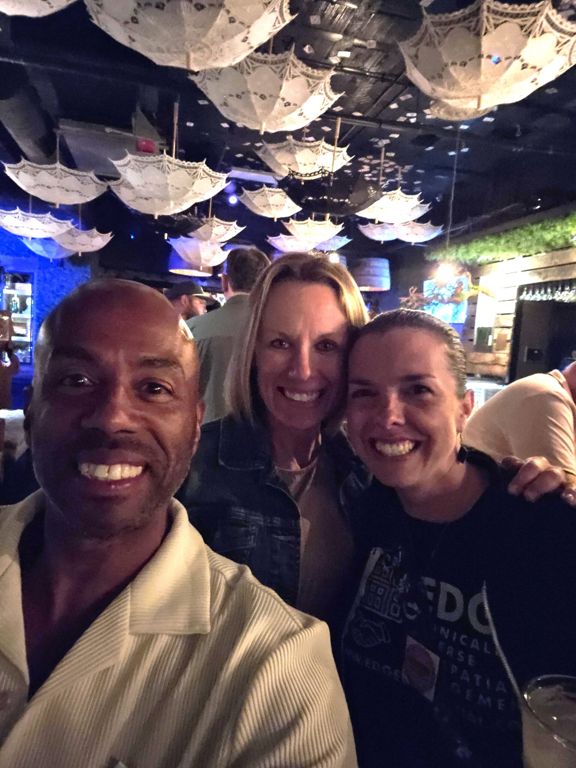
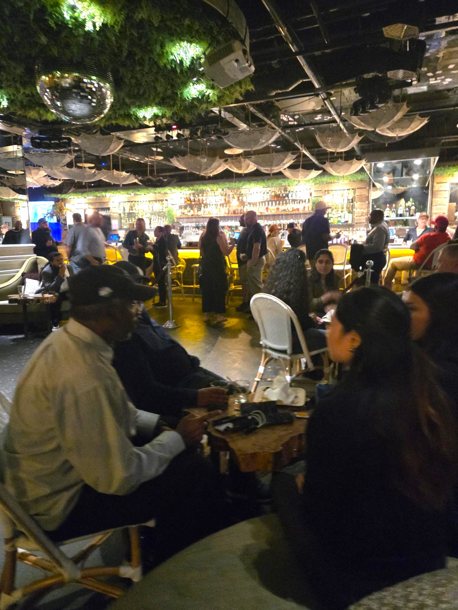
As with prior years, GeoMarvel attended EDGE Geospatial’s Sunday Social, hosted by Keith A. Searles, founder of EDGE & CEO of UrbanGIS. Attendees gathered for an evening of networking, refreshments, and discussions around future collaboration. GeoMarvel was proud to sponsor the social for a third year and to help introduce several partners to EDGE, an initiative focused on building a more ethnically diverse geospatial community through active engagement. Learn more or get involved at edgegeospatial.com.
This year’s Esri User Conference made one thing clear: the future of GIS lies in integration. The theme, “Integrating Everything, Everywhere,” captured how organizations are approaching modernization, system alignment, and data-driven decision-making.
Esri President Jack Dangermond opened the 45th Esri User Conference by celebrating the GIS community’s global impact and growth, noting over 10 million users across 700,000 organizations worldwide. He emphasized that the heart of the conference remains the same as it was in its early years—connecting people, sharing work, and learning from one another. With virtual audiences joining from across the globe, Dangermond encouraged attendees to appreciate the diversity in the room, representing disciplines from conservation and planning to engineering and emergency management.
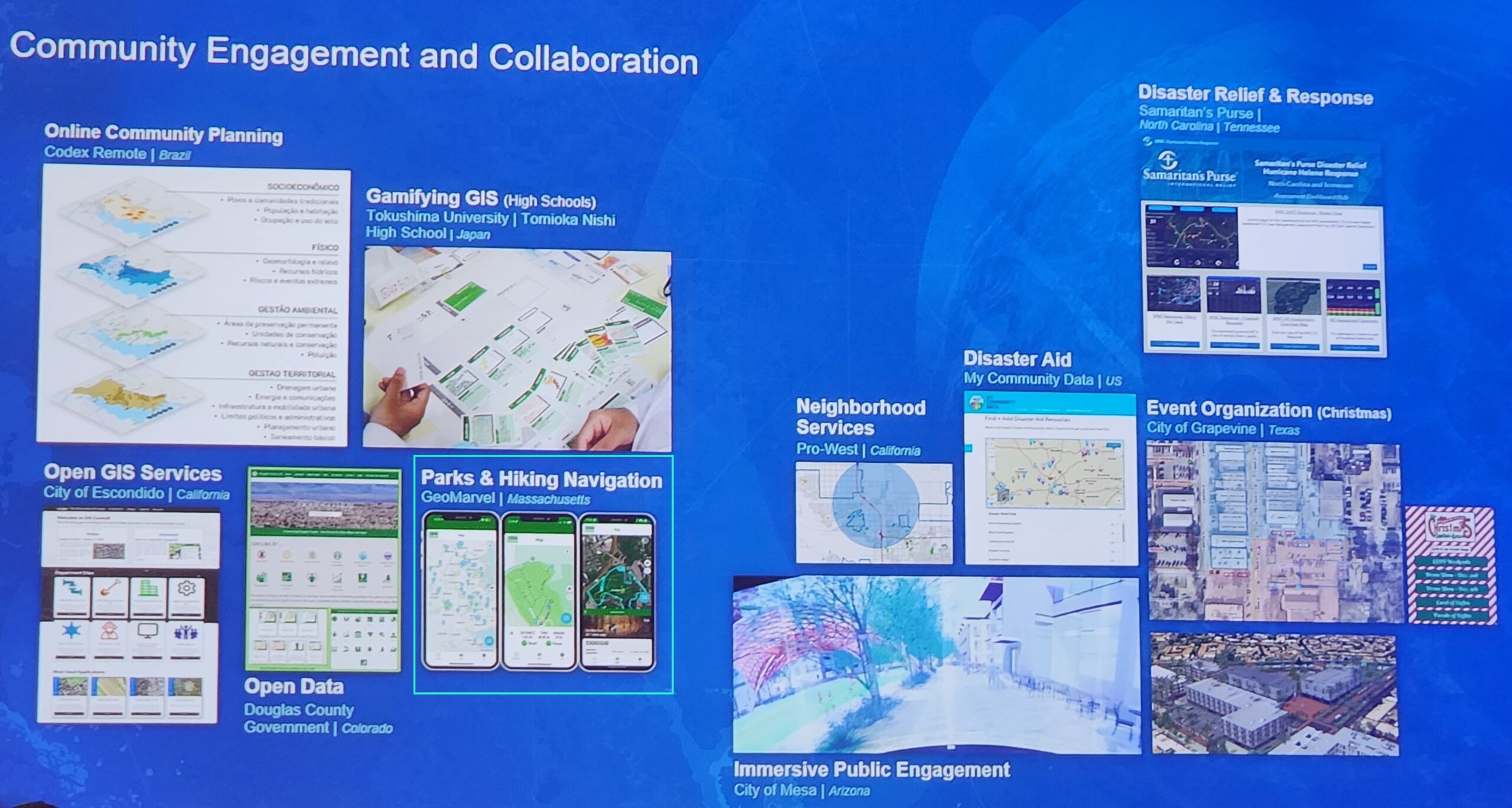
Several innovative GIS applications were highlighted in the conservation science, land and resource management, agriculture, urban planning, and climate mitigation industries. From mapping biodiversity and monitoring peatlands in the Congo to optimizing waste collection routes, Jack demonstrated how spatial data is being used to solve complex, real-world challenges. He also praised large-scale collaborative efforts, such as the International Geodesign Consortium, which is using local-to-global workflows to address climate change and urban development.
Dangermond emphasized GIS’s expanding role in critical infrastructure, public safety, and resilience. He shared examples of how utilities are using GIS for 3D digital twins, predictive maintenance through AI and imagery, and real-time risk assessment. In public works and emergency response, GIS is supporting mutual aid coordination, flood forecasting, and wildfire simulation. He called attention to how GIS is increasingly integrated with AI, real-time data, and imagery—transforming how we understand and respond to both everyday operations and large-scale disasters.
Finally, Dangermond celebrated the artistry and storytelling power of maps, reminding the audience that each map reflects not only data, but the people and institutions behind it. He shared a selection of visually striking and meaningful maps—from Lego-style renderings to precision cartography by Swisstopo—underscoring that maps are a universal language.
GeoMarvel even got a shout out for our work on the Greenbelt Go Mobile Application for the Essex County Greenbelt Association!
The following are a few notable presentations that provided exciting insights into recent innovations or resources that are of value to the broader GIS community:
ArcGIS is Being Enhanced with AI
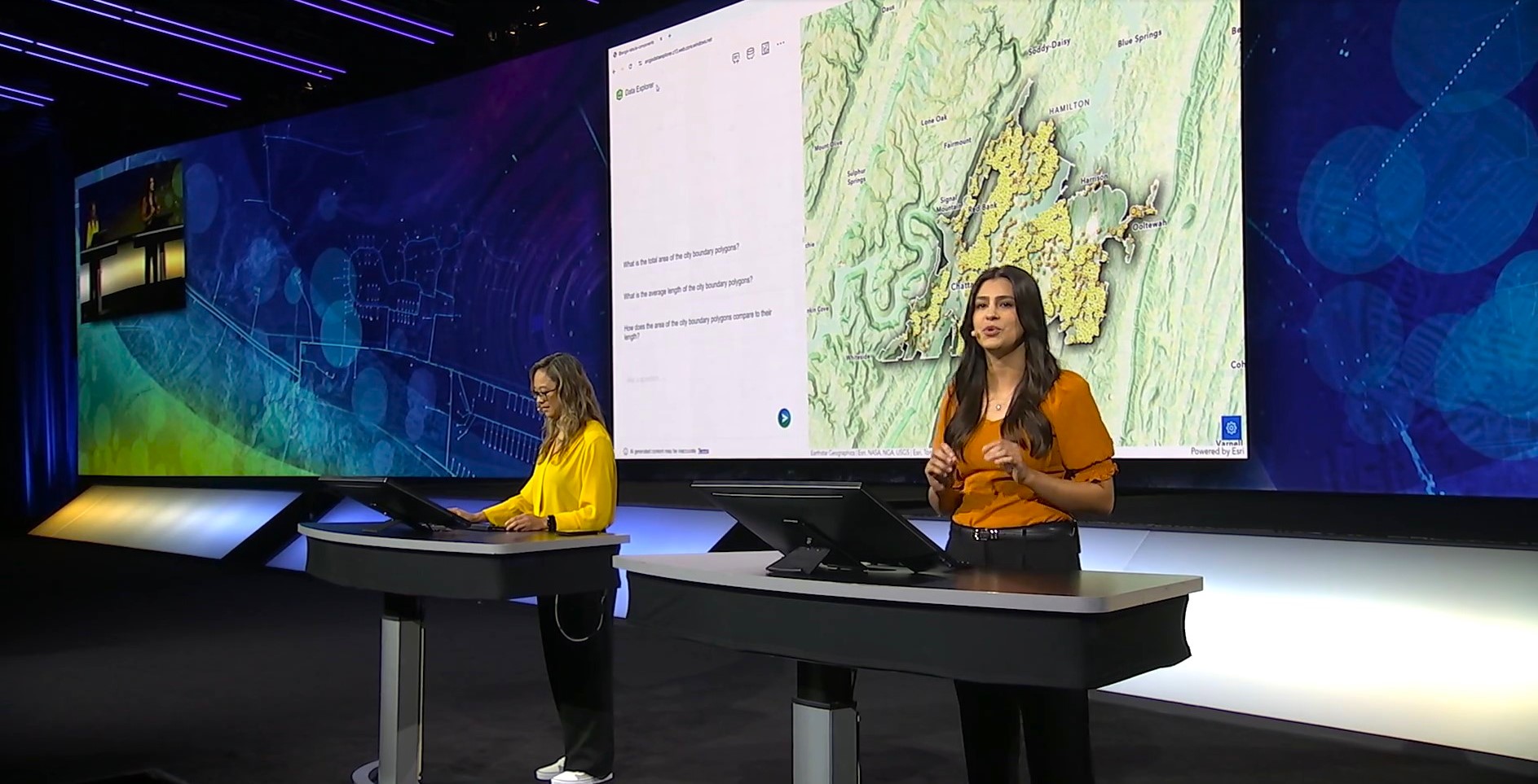
In “ArcGIS is Being Enhanced with AI,” presenters showcased how artificial intelligence is reshaping geospatial workflows across the ArcGIS platform. Using Chattanooga, Tennessee as a case study, they demonstrated how apps like ArcGIS Survey123 can now automate data entry tasks—such as describing issues, identifying hazards, and categorizing requests—from a single uploaded image. Voice-to-text features supporting multiple languages were also highlighted, making data collection more accessible and inclusive.
The session also showed how AI in ArcGIS Pro, through GeoAI tools, can detect road damage in images by training a deep learning model with minimal input—automating tasks that once took weeks. Tools like Model Builder Suggestions and the ArcGIS Pro AI Assistant help users build workflows using natural language, while the ArcPy Assistant generates Python code to classify road segments by damage level.
Presenters closed by emphasizing AI’s role in improving communication. With the ArcGIS Arcade Assistant in Map Viewer, users can generate custom-styled pop-ups from simple prompts. A partner demo by Halcia Levine featured a zoning assistant that responds to community questions using city GIS data. The session highlighted how AI is now woven into ArcGIS across desktop, web, and mobile—empowering users to work faster and more efficiently.
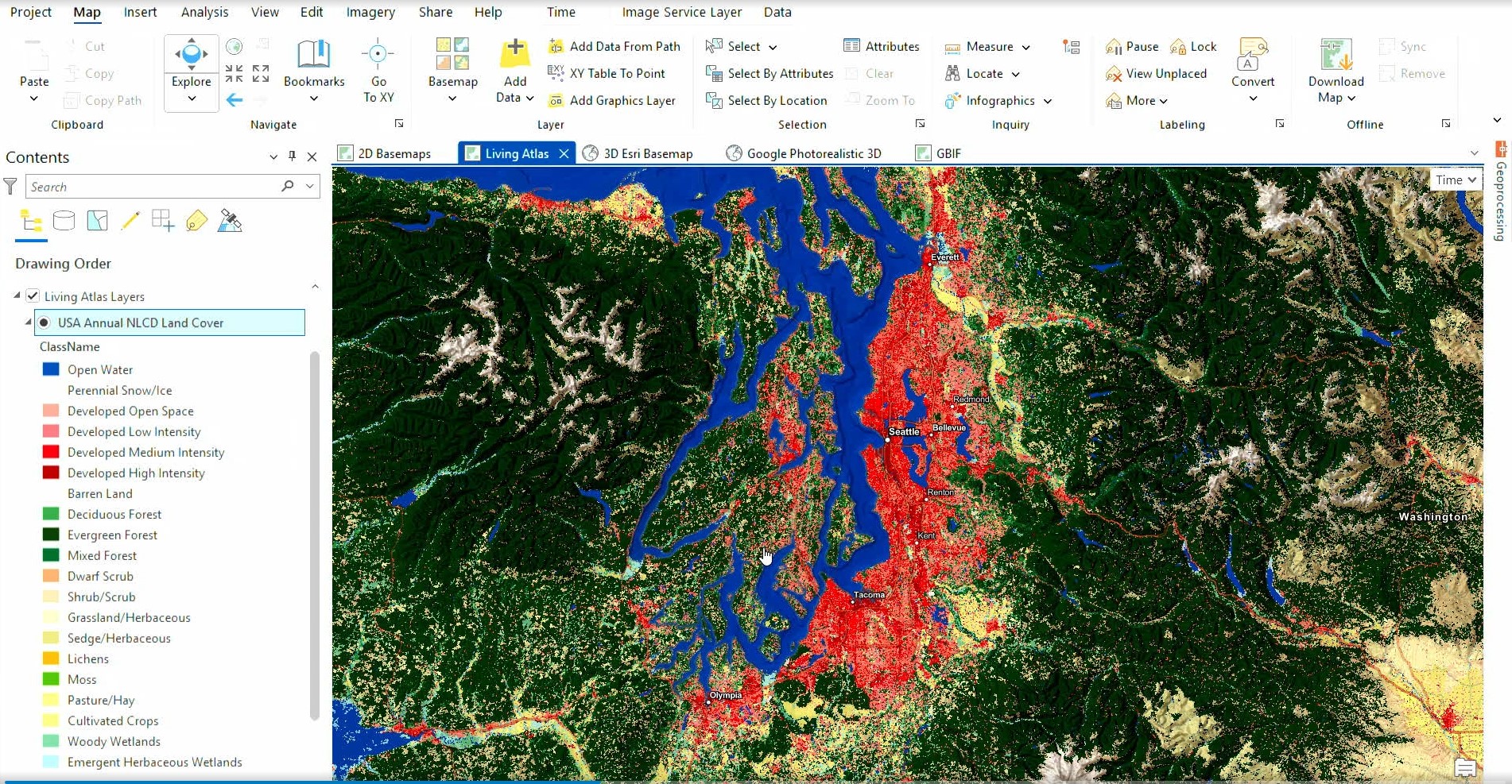
Integrating the ArcGIS Living Atlas of the World with Your Apps
“Integrating the ArcGIS Living Atlas of the World with Your Apps” highlighted how the ArcGIS Living Atlas enhances maps, apps, and workflows with authoritative, real-time content. Starting with basemaps, the speaker showcased options like World Imagery, Outdoors, and Community Basemap—demonstrating how local data contributions, such as those from Yakima, enrich the experience. New additions like World Navigation with built-in points of interest and seasonal imagery from NAIP add further versatility.
The session moved into thematic and 3D content, featuring the updated National Land Cover Database (NLCD) and new bioclimate projections from the CHELSA collection. The enhanced 3D Buildings Basemap now includes detailed partner data from Maxar, TomTom, and Overture Maps. A preview of photorealistic 3D basemaps from Google Maps Platform illustrated expanded global visualization options.
The presentation concluded with a new geoprocessing tool that extracts species data from the Global Biodiversity Information Facility (GBIF), and a demo of the Skywatch Content Store (click here to learn how GeoMarvel partnered to bring this to life!), where users can purchase up-to-date satellite and aerial imagery. Whether mapping urban change, climate, or biodiversity, the Living Atlas delivers the trusted data needed to support your work.
Interconnecting Workflows, Data Management, and Editing Improvements
In “Interconnecting Workflows, Data Management, and Editing Improvements,” the presenter shared new editing enhancements across ArcGIS Pro, ArcGIS Online, and ArcGIS Field Maps—built to simplify infrastructure mapping. Using a proposed data center in Ann Arbor as an example, the session began with parcel management via the new COGO Reader (coordinate geometry), which extracts and maps legal boundaries directly from PDF deeds. The improved Vertices and Nodes tool helps spot and fix topology issues with easy visual cues.
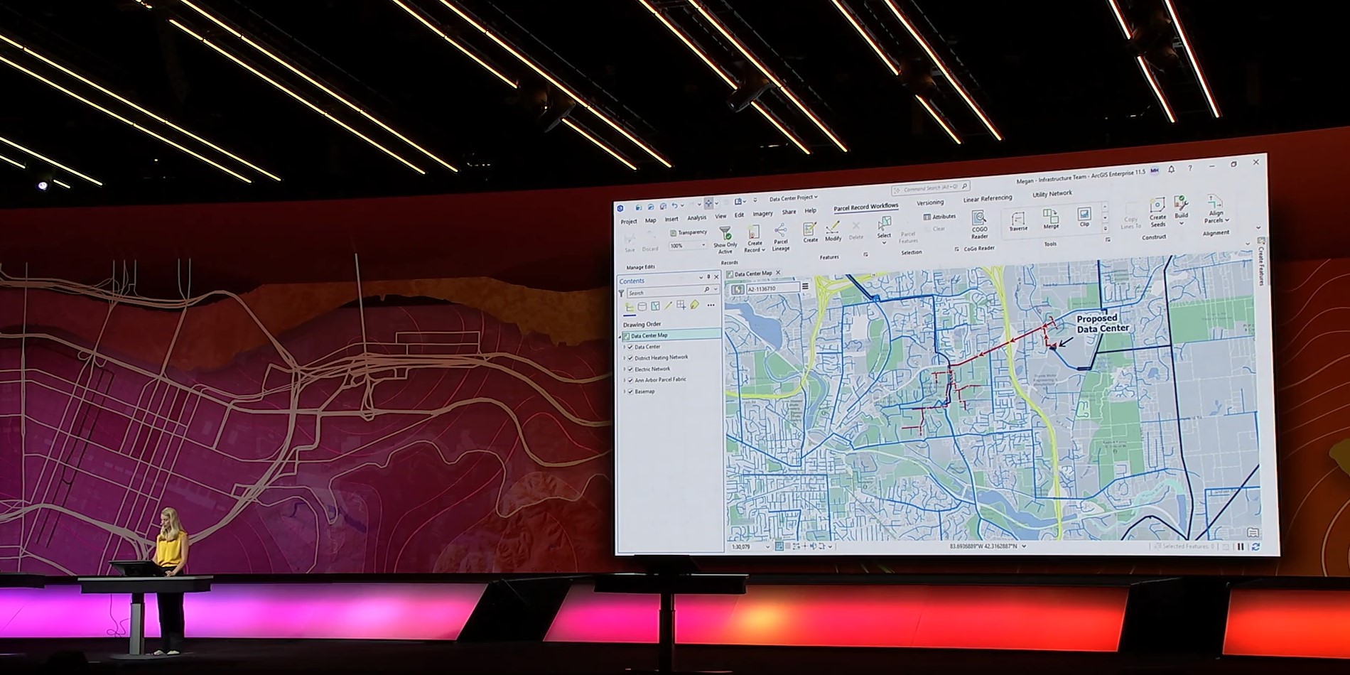
The redesigned ArcGIS Web Editor was also showcased, featuring editing grids, group and preset templates, and batch editing—enabling users to map complex infrastructure like electric networks with greater efficiency.
In the field, ArcGIS Field Maps now includes a to-do list for task prioritization and SmartForms in Edit Multiple, allowing rule-based updates—even offline. The session emphasized how ArcGIS now enables fully connected editing workflows across desktop, web, and mobile, streamlining critical data management.
GeoMarvel was privileged to participate in three different sessions at this year’s User Conference.
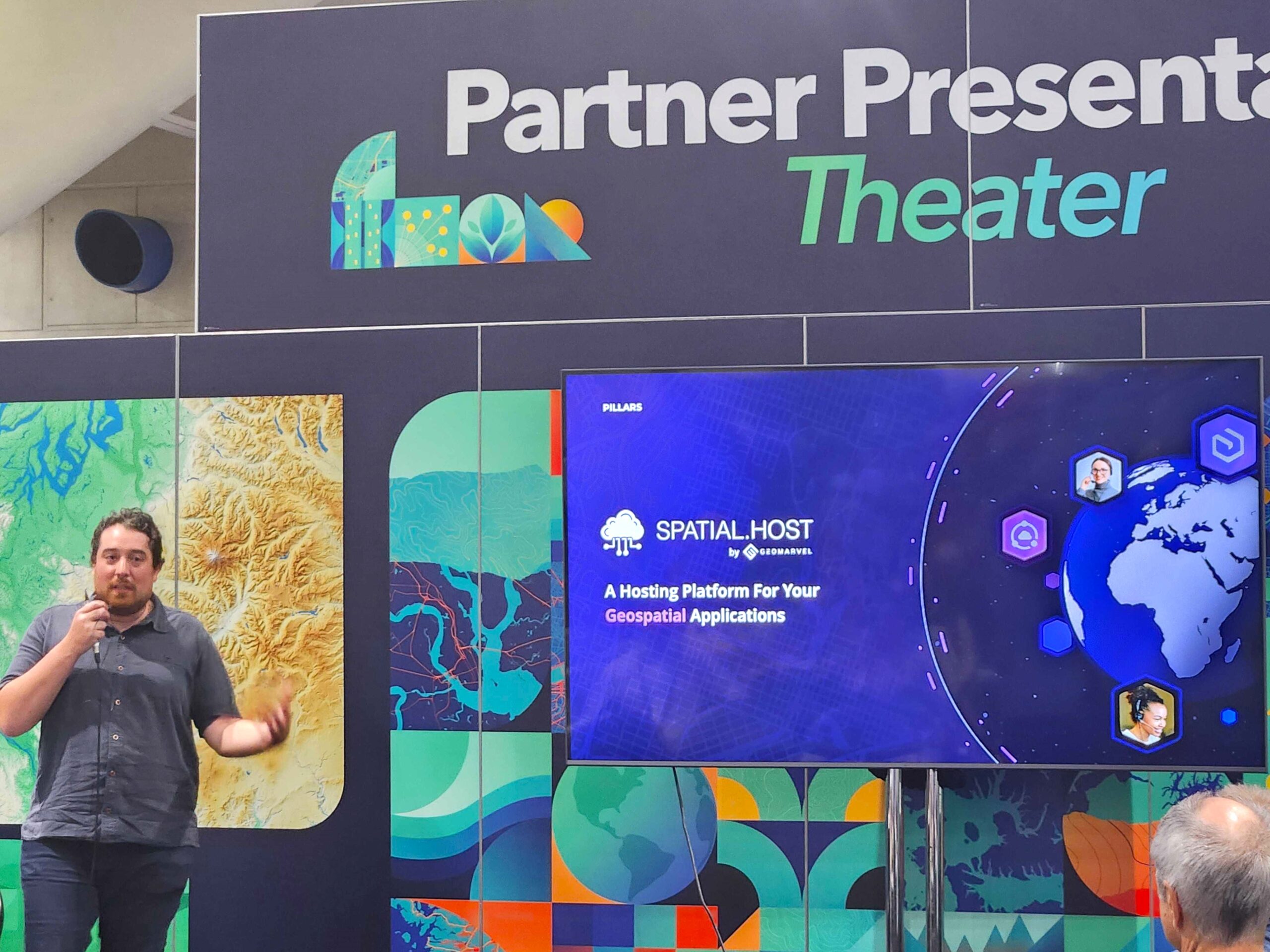

Jon Nordling presented a Partner Lightning Talk titled “Transform Your Geospatial Infrastructure with Spatial.Host.” Attendees got a fast, impactful overview of Spatial.Host—the fully managed geospatial hosting platform designed for simplicity, scalability, & security. This lightning talk showcased how Spatial.Host streamlines cloud hosting, automates deployments and backups, & ensures high availability with built-in managed services and strong security features.
In addition to the Lightning Talk, GeoMarvel held a one-hour Partner Presentation titled “Spatial.Host: A Fully Managed Geospatial Hosting Platform – Features and Roadmap” which was a more thorough deep dive into the product & how it modernizes the deployment process of geospatial systems.
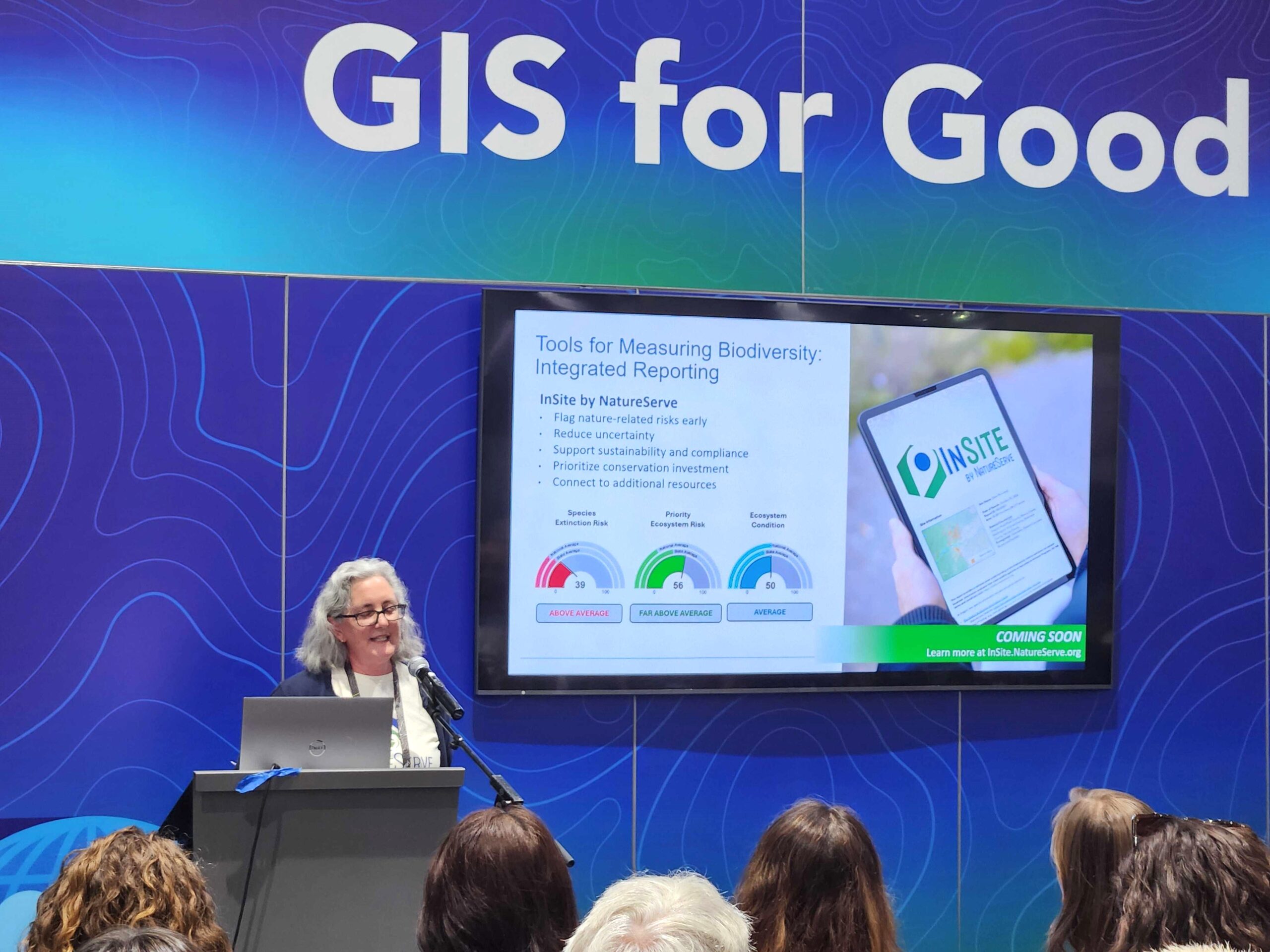
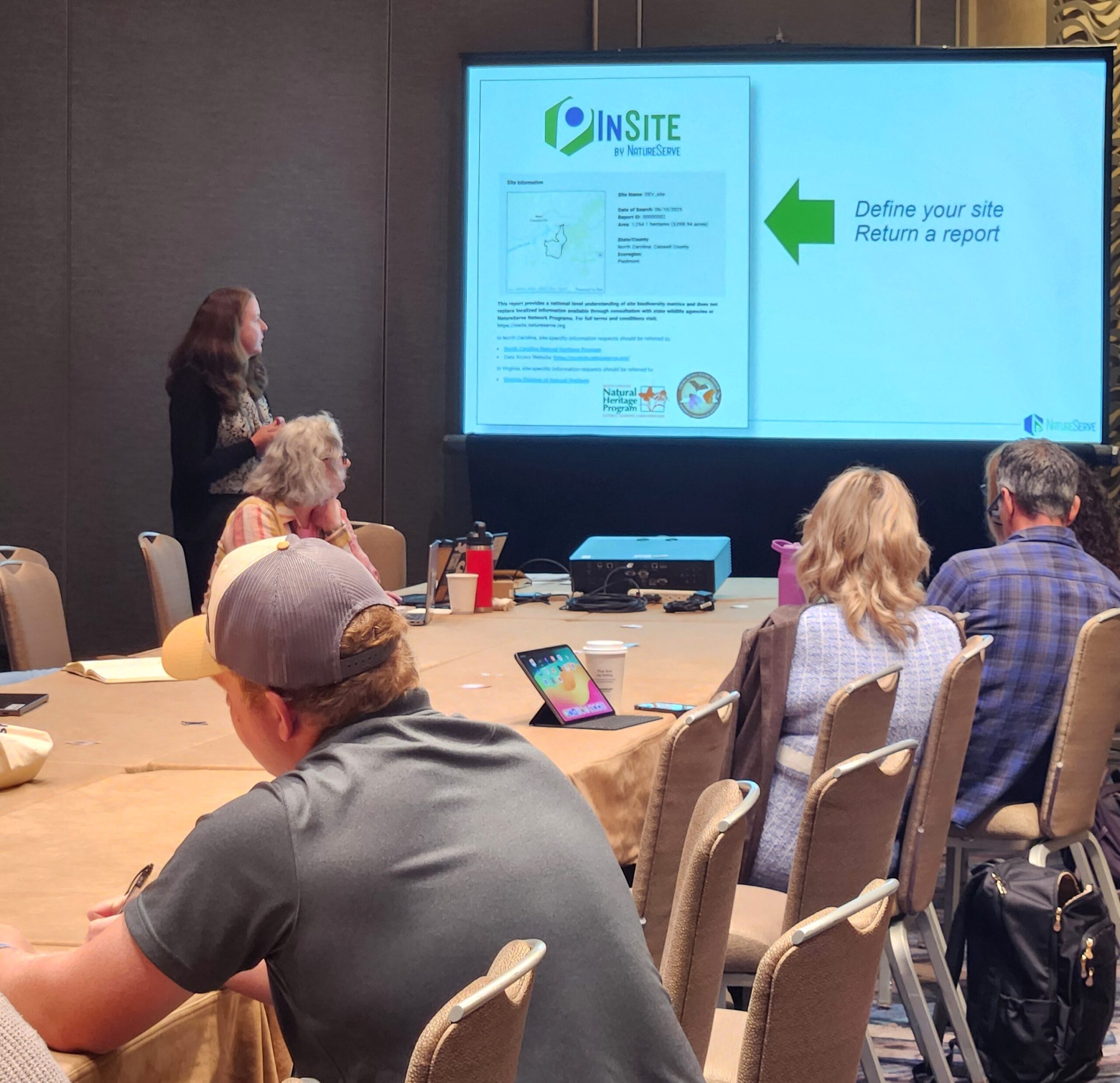
Finally, our friends at NatureServe held a presentation titled “Nonprofit & Business Forum: Biodiversity Data Insights” that brought together practitioners, data providers, and tech developers to discuss the growing spatial data needs for assessing biodiversity risk and value in both business and conservation. The session featured an overview of key biodiversity data resources—including those from NatureServe—and demonstrated how these datasets support risk assessments, regulatory reporting, and conservation planning.
Attendees shared current challenges, helped shape future tools, and provided feedback on NatureServe’s new biodiversity reporting product, InSite, developed with GeoMarvel who also assisted with the demo portion of the presentation.
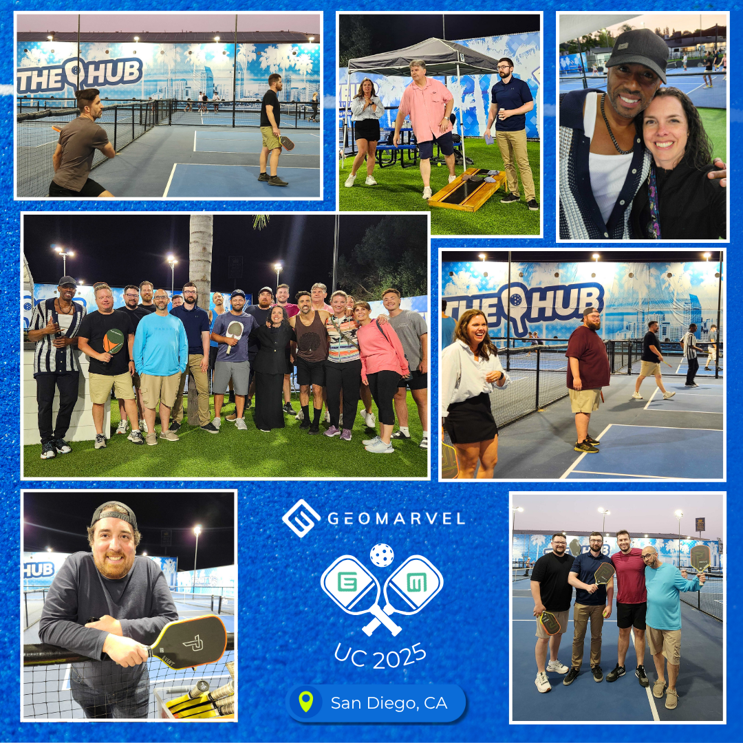
For the first time ever, GeoMarvel hosted a UC Pickleball Social at The Hub – San Diego, about 20 minutes away from the San Diego Convention Center.
Attendees got to enjoy some friendly competition, food & drinks, yard games, and a fun offsite networking opportunity. We’re looking forward to hosting other fun social events like this in the future!
The 2025 Esri User Conference was an inspiring reminder of the power of GIS to connect people & solve global challenges. From AI-driven workflows to rich data tools like the Living Atlas, the innovations on display this year reflected a deep commitment to integration, accessibility, and collaboration across the geospatial community. GeoMarvel was honored to take part—whether presenting new solutions, supporting partners, or hosting a bit of fun at our first-ever Pickleball Social.
As we reflect on an incredible week of learning and connection, we’re energized by the momentum driving our industry forward. The future of GIS is brighter than ever, and we’re excited to continue building impactful solutions, forging new partnerships, and pushing boundaries—together. Until next year, thank you to everyone who made this year’s UC unforgettable. Let’s keep mapping what matters.


Is your organization in need of professional support or Managed Services? Look no further than GeoMarvel. We have a broad range of offerings & our dedicated team is here to fulfill all your geospatial needs. Our team of industry experts are here to assist you every step of the way. Don’t hesitate to contact us to discover how GeoMarvel can elevate your organization to new heights!