
The GeoMarvel team was honored to attend Esri’s 44th User Conference in San Diego this year! Our team was represented by CEO Jon Nordling, Dalton Bloom (Director of Managed Services), Corey Norris (Director of Professional Services), Ryan McGrath (Senior Project Manager), and Matt Milideo (Senior Application Developer). Much was learned & shared at the 2024 UC and we’re excited to share the highlights with you today.
Check out Esri’s playlist to view the Plenary Sessions!

Prior to the excitement of User Conference kick-off on Monday July 15th, GeoMarvel attended EDGE Geospatial’s Sunday Social, hosted by Keith A. Searles, founder of EDGE & CEO of UrbanGIS. Over 70 attendees enjoyed an evening of refreshments, networking, and exploring future opportunities for collaboration. GeoMarvel was honored to sponsor this social for the 2nd year in a row & to introduce some of our partners to EDGE, which is committed to building a more ethnically diverse geospatial community through active engagement. For more information on EDGE and how you can get involved, visit edgegeospatial.com.
This year’s User Conference theme was “GIS – Uniting Our World”, focusing on inclusion and collaboration using the common language of geography, and empowering individuals and organizations to make a difference in the world. During Plenary, Jack Dangermond reiterated Esri’s primary goals: serving their users & the broader GIS community, advancing GIS & the science that it is based on, promoting spatial literacy in order to foster strong partnerships, solve real world problems, and develop sustainable solutions that meet the needs of real communities & organizations. In addition, Jack announced the release of his latest book, “The Power of Where” which details the history of GIS, Esri, and is full of web maps, illustrations, and stories sure to be interest to the GIS enthusiast, but also very informative to anyone wanting to learn more about the geospatial industry & the technologies utilized within it.

During the presentation “Exploring New Mapping and Cartography Capabilities”, attendees were treated to first looks at various ArcGIS product enhancements, including auto-apply, group layer radio buttons, and the ability to copy and paste layer properties in ArcGIS Pro, 3D interactivity on web Dashboards, and iNaturalist Observations in the Living Atlas. iNaturalist Observations allow users to submits georeferenced photos so they can discover what species they are looking at. This includes many different groups including plants, all animal types & fungi. The presenter also highlighted a new feature in Map Viewer that allows users the ability to save a configured layer of Wurman dots as a new layer item that can be easily shared and reused.
In “Understanding Data Management and Editing Improvements,” we learned about additional enhancements to ArcGIS Pro & ArcGIS Online. For ArcGIS Pro, for instance, we learned about editing workflows with non-versioned data, a new snap chip for quickly creating data with varying z-values, & a schema reporting tool that you can export to the file type of your choosing. They can even be exported to Excel & reimported to ArcGIS Pro to a new geodatabase. The speaker also presented the new ArcGIS Web Editor, designed to provide a streamlined and focused editing experience for users who need web-based editing capabilities. Esri also announced the launch of ArcGIS Data Pipelines to enhance data integration and workflow efficiency in ArcGIS Online.
During the “ArcGIS Business Analyst” presentation, we were excited to learn of the release of a new AI assistant for ArcGIS Business Analyst. This assistant utilizes suggested prompts to help users to create maps, search points of interest and also use it as an educational tool so you can further enhance your data. The AI assistant will even highlight the field(s) or tool(s) needed to achieve the outcome you want with your map. The presenter also showed the extensive library of Infographics available to view & share and the capability to create your own infographic.
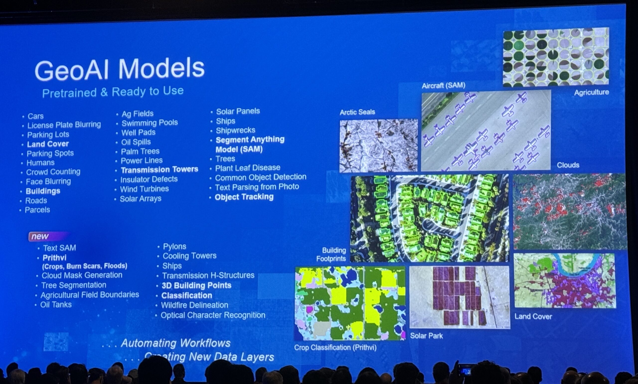
Lastly, in “The Rapid Evolution of Artificial Intelligence,” attendees got to see just how much of an impact generative AI (or assistants) is having on various ArcGIS products and by extension, helping GIS professionals to be more agile and productive. The first example showcased the Mapping Assistant in the ArcGIS Map Viewer. The presenter entered a natural language prompt for FEMA’s National Risk Index data set: “show high temperatures in red” and within seconds, the map’s visualization updated to reflect & also highlighted the field that was used to generate the visualization. From this initial request, the presenter added more complex requests, which the assistant addressed with the same ease & speed as the first. In his second example of AI assistants, we took a look at ArcGIS Pro. This assistant currently under development allows users to enter in their criteria or fields of interest and the assistant will write the SQL query for the user in a matter of seconds, saving the user valuable time. The final AI assistants shown were for ArcGIS Survey123. The first Survey123 assistant allows users to simply enter a prompt for a survey & the AI generates a survey in draft form. The user can make adjustments if needed but once approved, the survey is ready for distribution. The second Survey123 assistant, referred to as “computer vision”, extracts information from images which populates the fields of a survey for submission. This assistant was able to populate yes/no fields and even provide a brief description of the image itself in short form natural language format. We are excited to see how else Esri will leverage the power of AI in their existing and newer products!

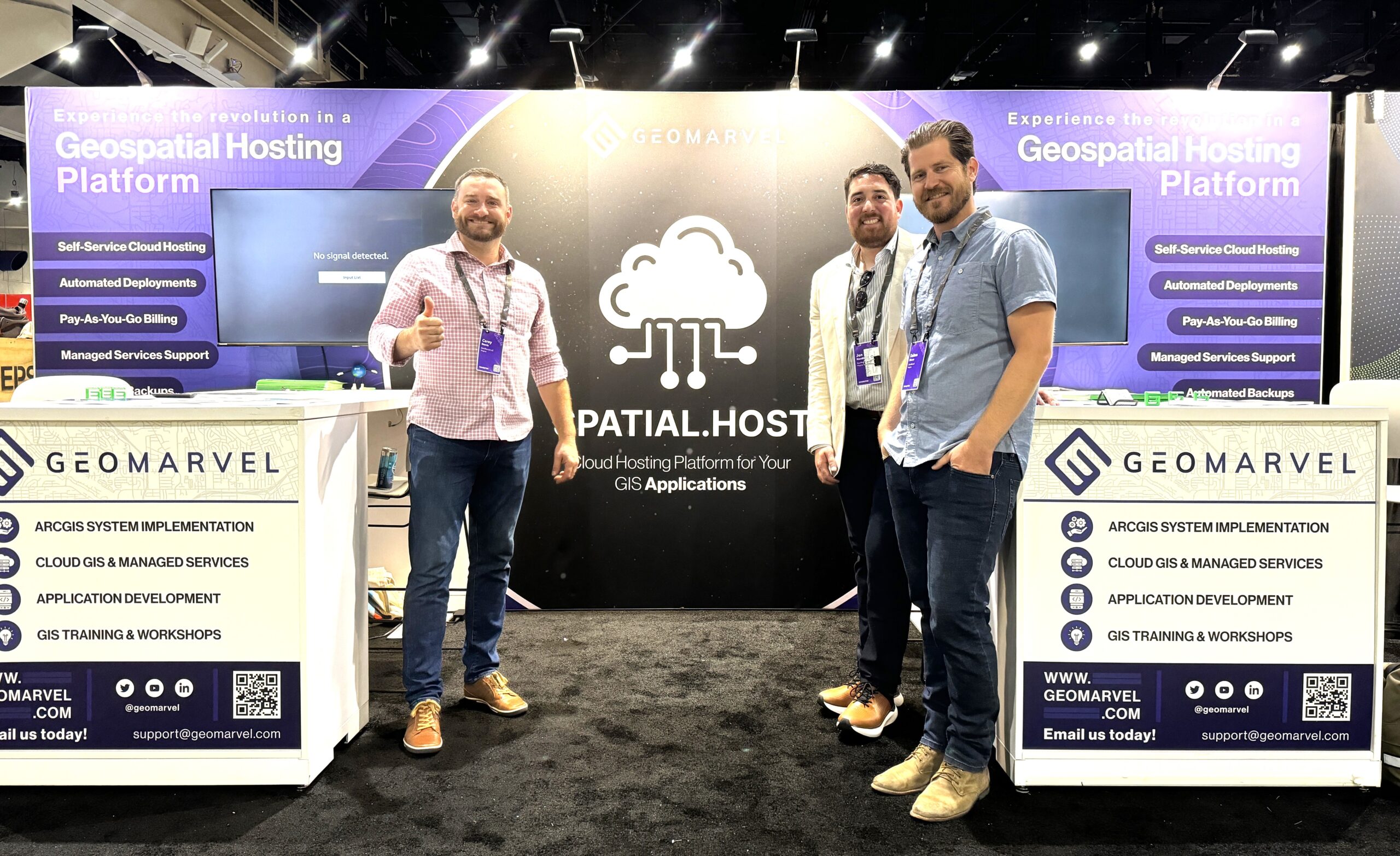
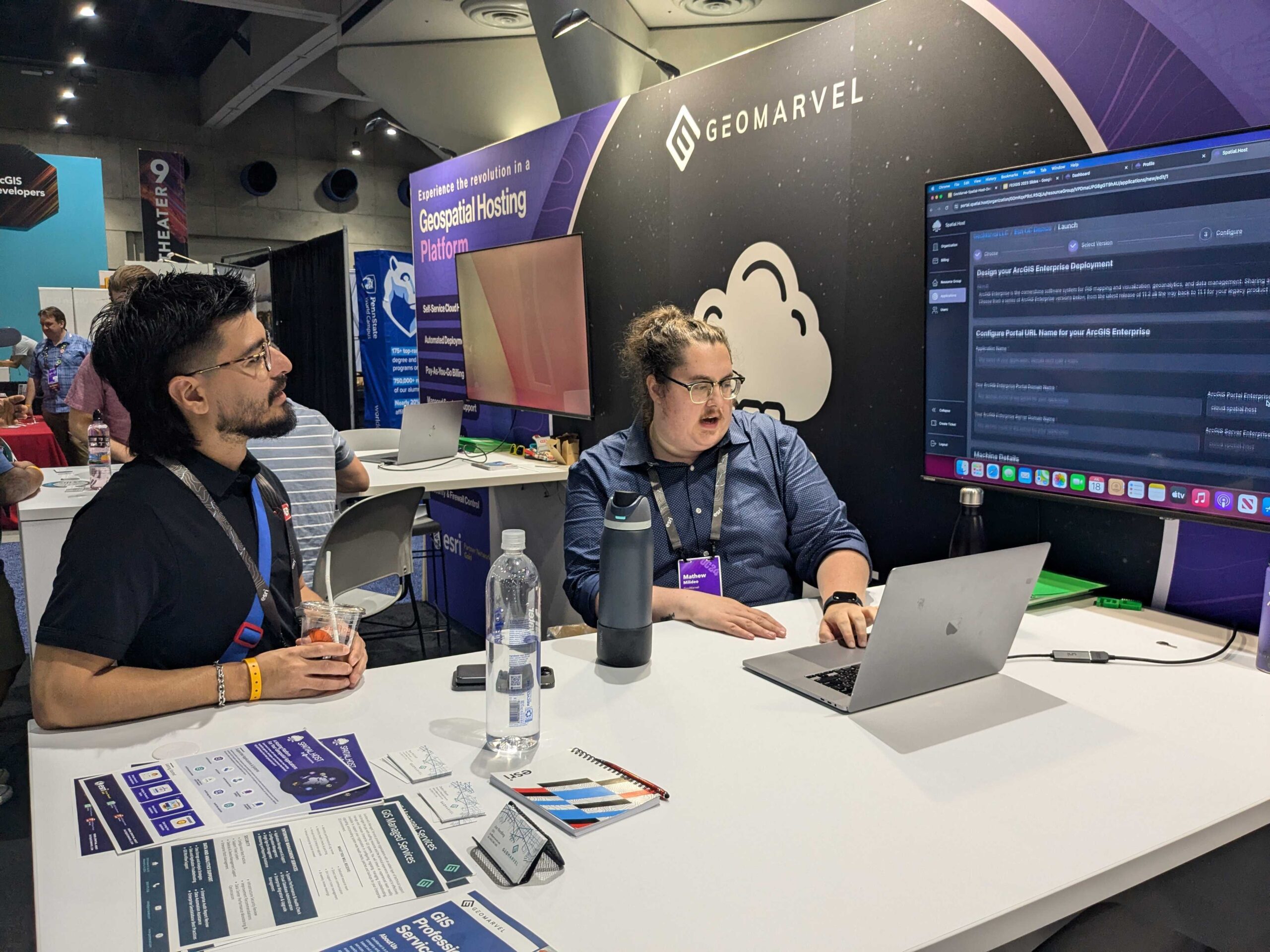
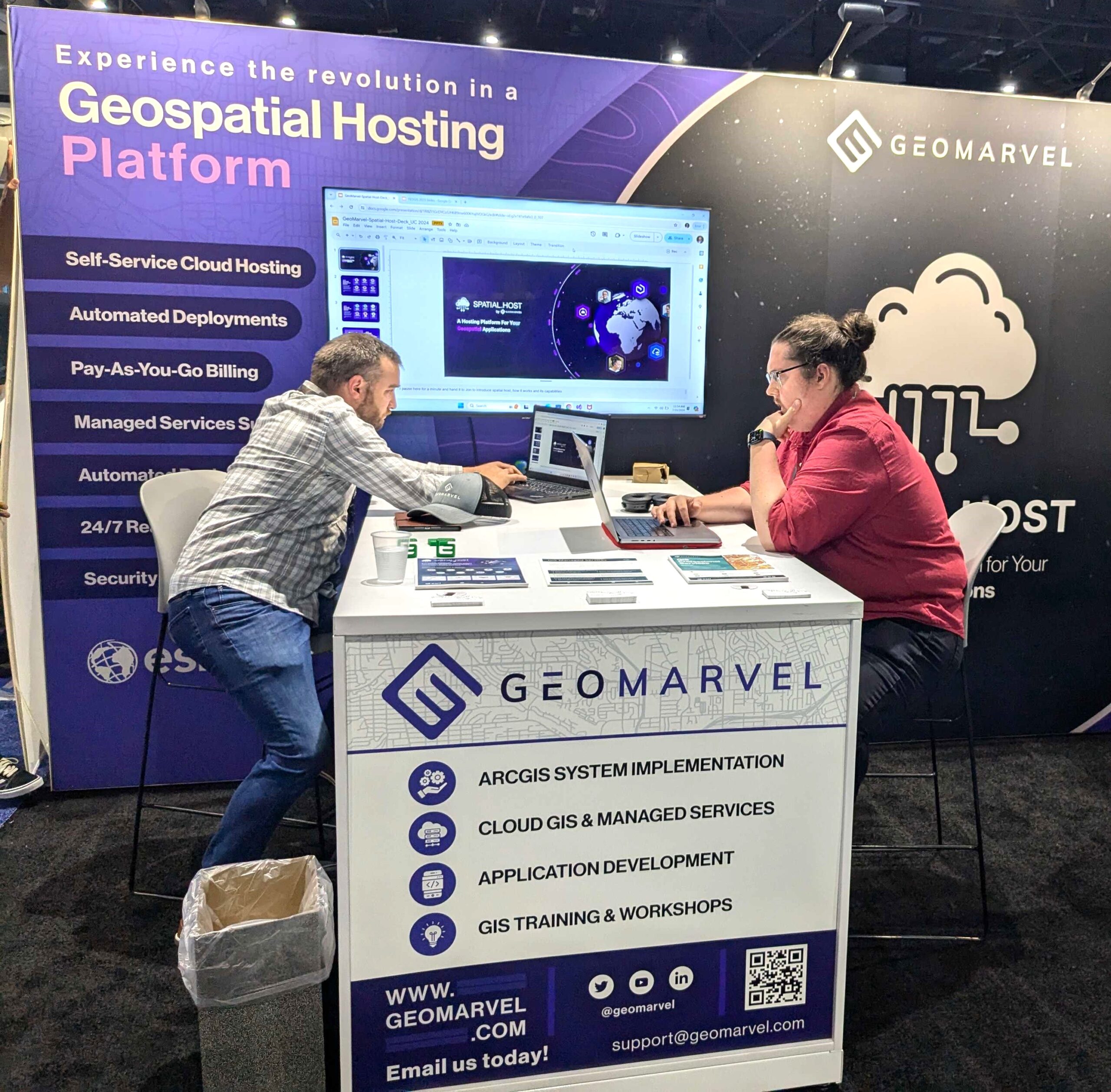
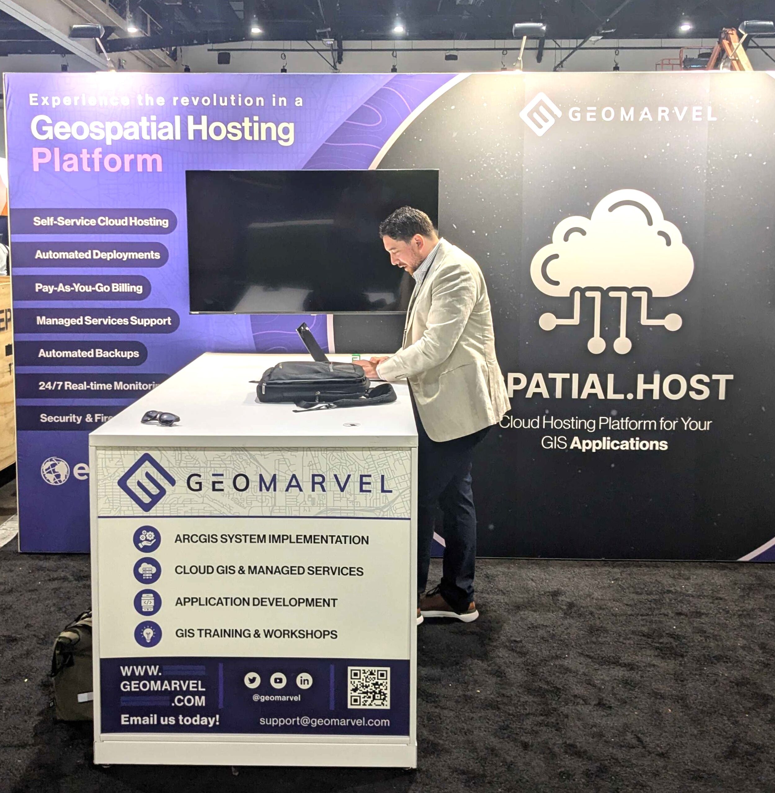
This year, the GeoMarvel team hosted our own Expo booth for the commercial launch of Spatial.Host, a fully managed geospatial hosting & deployment platform, designed to allow users to self-serve and address the unique needs of their GIS applications, databases, tools, and workstations. Operating as a private cloud, Spatial.Host focuses on delivering a seamless & hassle-free setup process, reducing the installation and configuration of Cloud resources and GIS Software from days and hours to just minutes.
The reception from clients & conference attendees was overwhelmingly positive. Our team was able to provide many live demos during each Expo day, share pamphlets providing more detailed information about Spatial.Host’s key features, and answer questions while showcasing its capabilities in real-time.
Spatial.Host offers a range of powerful features that empower users to optimize their hosting environments and significantly reduce the time required for complex processes (including standing up ArcGIS Enterprise applications), resulting in substantial time savings for users:
For more information, visit www.spatial.host!
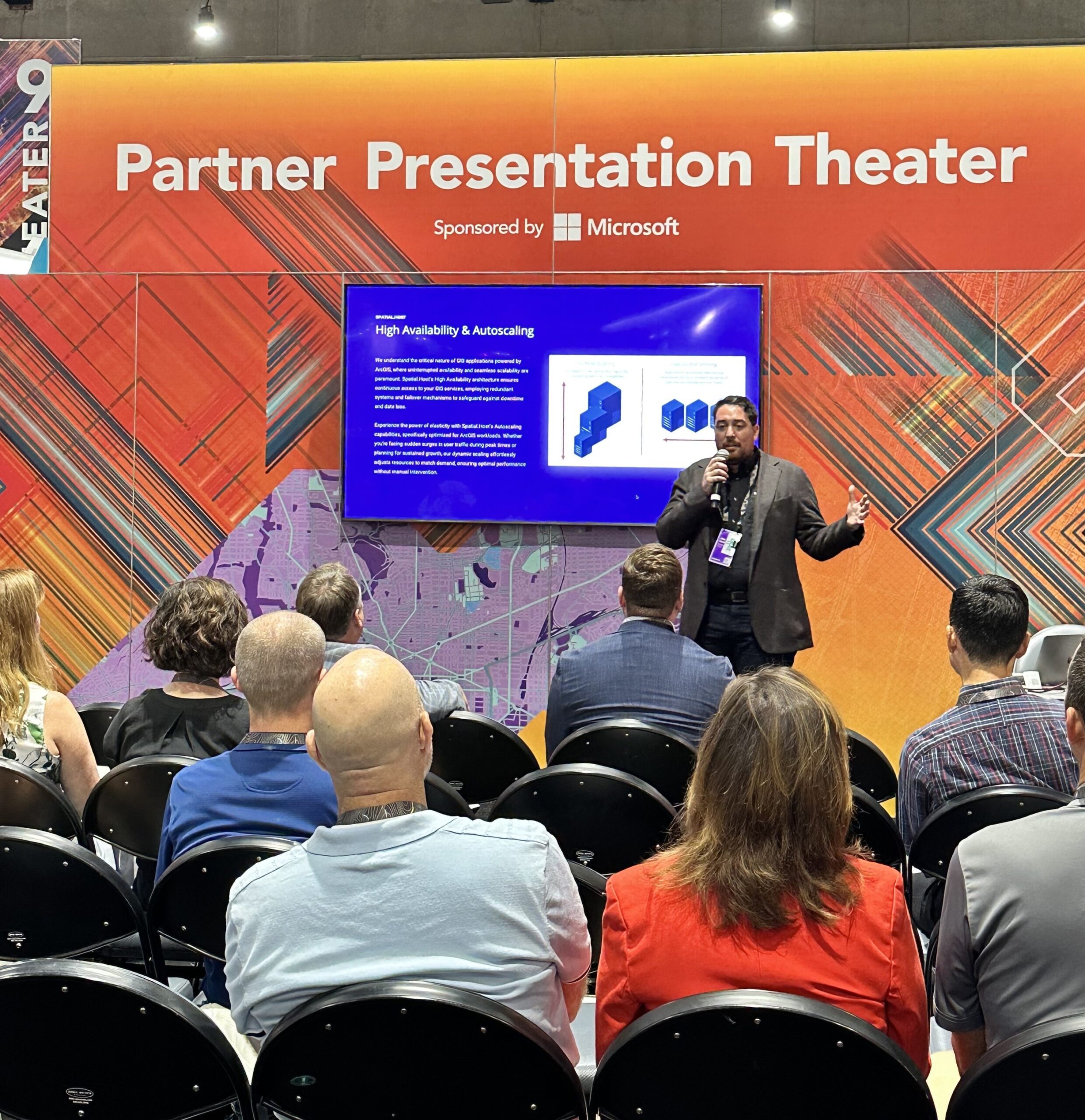
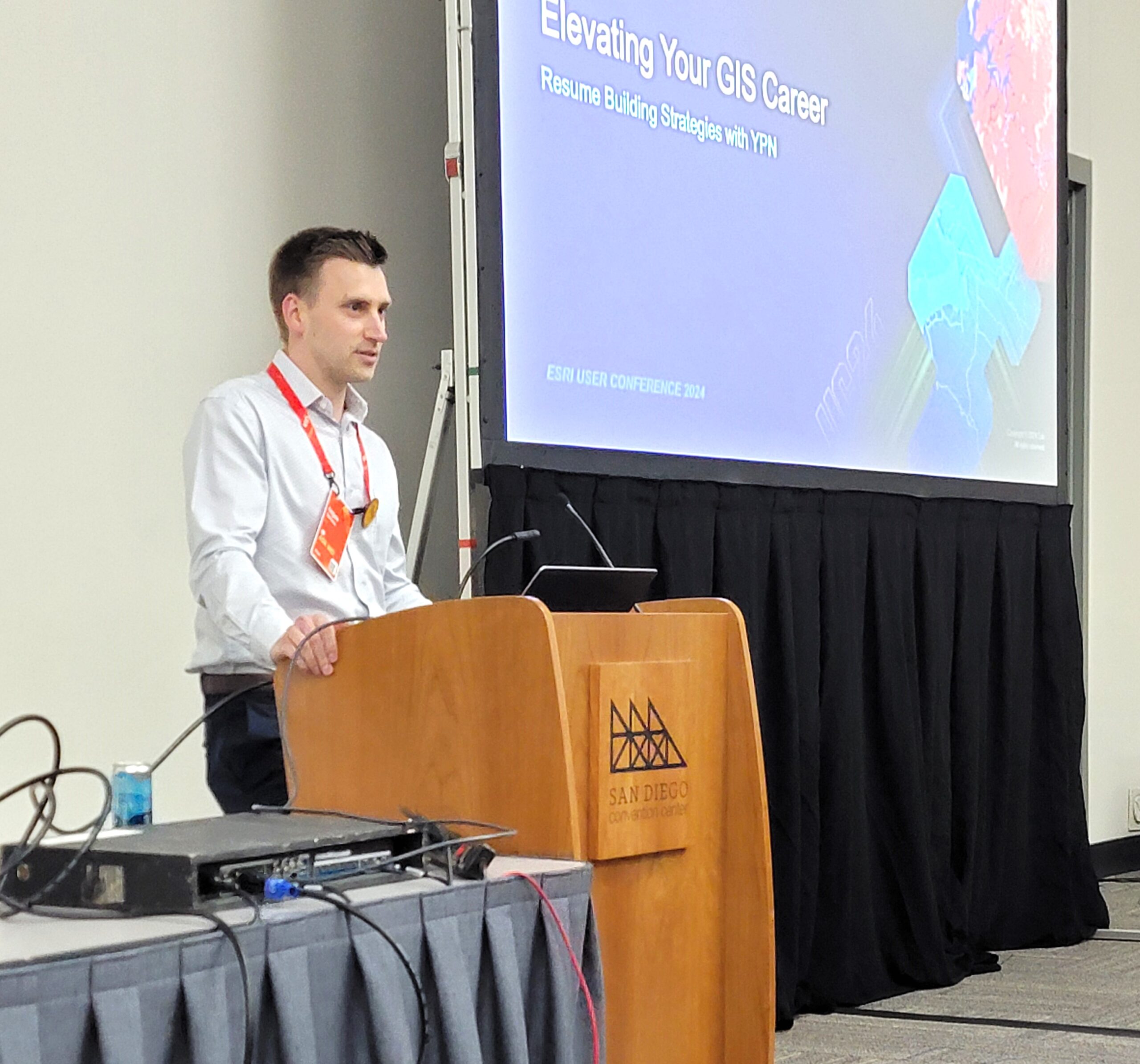
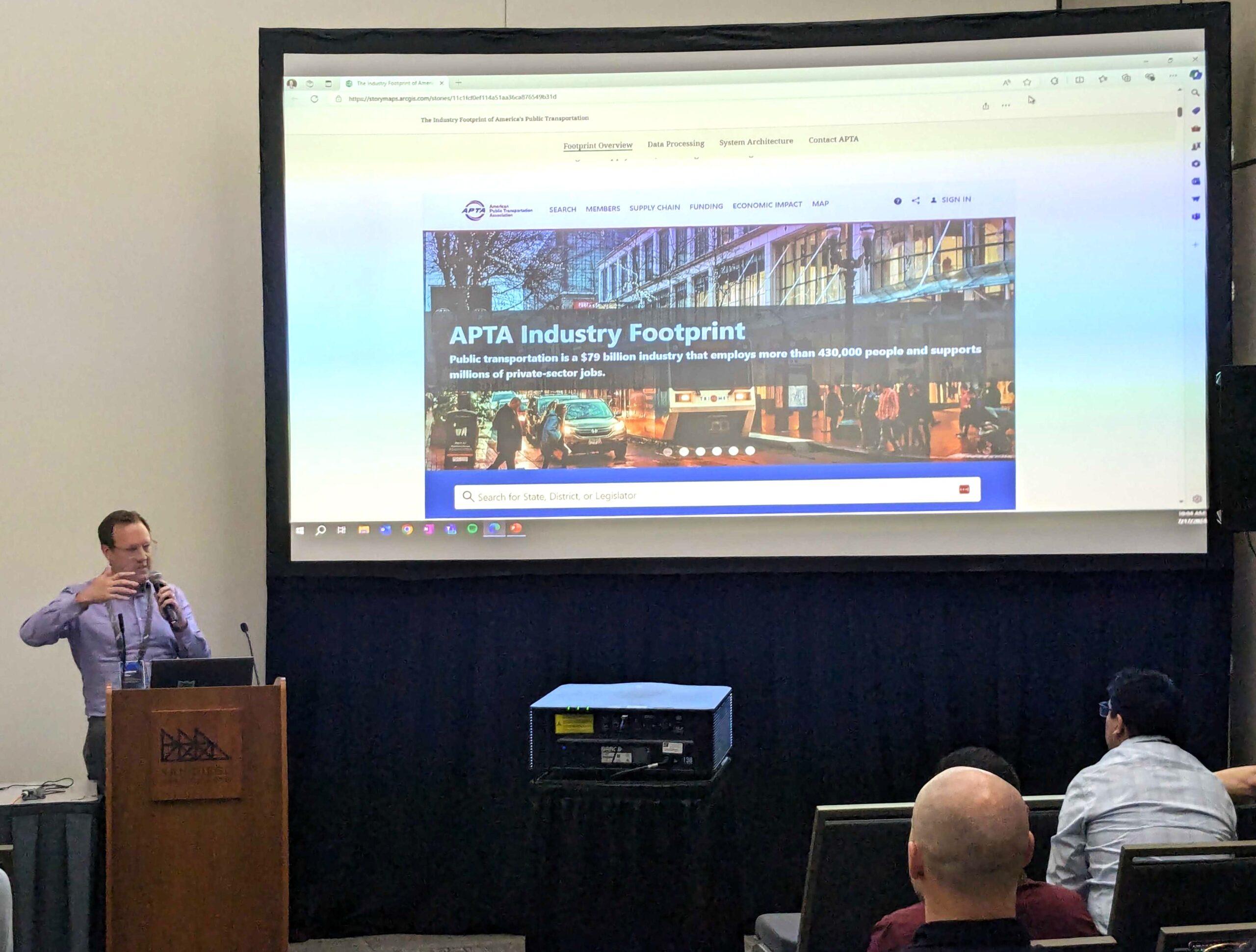
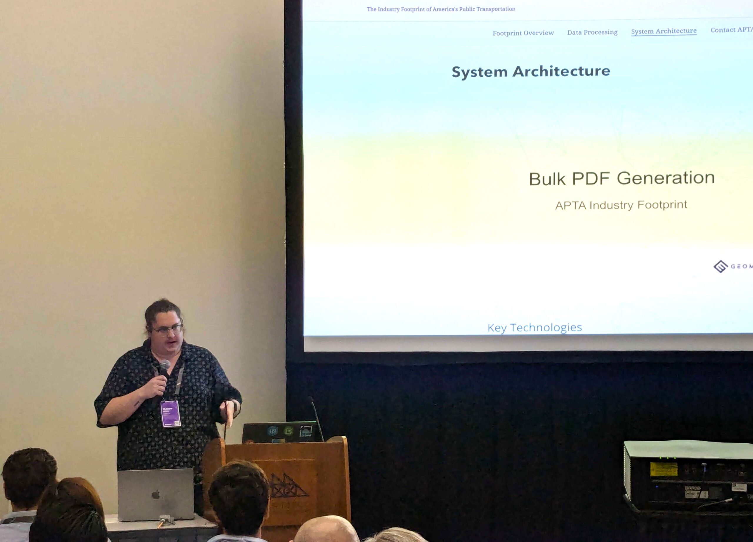
GeoMarvel was privileged to participate in three different sessions at this year’s User Conference:
Aside from Plenary, managing our booth, and presenting at various sessions, this User Conference was also a wonderful opportunity to strengthen existing client relationships, make new connections, and relate to other GIS professionals on a more personal level.
At GeoMarvel, we value being agile, proactive, and technologically savvy, but we also understand the importance of putting people first, relating to them in meaningful ways, and conveying our appreciation to our customers face-to-face. User Conference is where all the best parts of the GIS industry come together: the energy & passion for the “science of where”, the spark of innovation, the excitement for new ideas & possibilities, and the determination to make a better world for everyone.
We are so grateful for the opportunity to contribute our expertise and come away with learnings that will improve our customer’s projects & our own solutions as well. Thank you Esri & partners for an amazing User Conference and we’re looking forward to attending next year’s!


Is your organization in need of professional support or Managed Services? Look no further than GeoMarvel. We have a broad range of offerings & our dedicated team is here to fulfill all your geospatial needs. Our team of industry experts are here to assist you every step of the way. Don’t hesitate to contact us to discover how GeoMarvel can elevate your organization to new heights!